


Storm expert David Nolan explains what we know and what we're still trying to figure out.
Hurricane Florence is expected to hit the Southeast this week, though meteorologists have trouble saying precisely where along the coast it or any other hurricane will hit — and when.
Yet despite such uncertainty, there's little doubt that hurricane prediction and tracking have gotten better in recent years — in part because of the availability of new satellites and the use of drones that can fly into severe weather in ways that are impossible with crewed aircraft.
Just where are we with hurricane science? What have we learned, and what questions remain to be answered? And what about the role of climate change in the formation and propagation of severe storms?
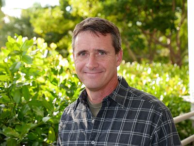
For answers to these and other question, NBC News MACH spoke via an online chat with David S. Nolan, professor and chair of the department of atmospheric sciences at the University of Miami's Rosenstiel School of Marine and Atmospheric Sciences and a noted expert on hurricanes and tropical weather. The interview has been edited for length and clarity.
MACH: The National Hurricane Center today upgraded Florence to a Category 4 storm. What exactly does that mean?
Nolan: It means that, by their best estimate, there are wind speeds somewhere at the surface of 130 miles per hour or greater. This estimate comes from a combination of satellite images, and, in this case, from NOAA [National Oceanic and Atmospheric Administration] aircraft that have been flying in Florence this morning.
How many categories are there?
The categories go from 1 to 5.
Could there ever be a Category 6?
No. Fives themselves are very rare. And reaching higher speeds — like 170 or 180 mph — is extremely rare. So it doesn't make sense to make a category for something that will still be extremely rare, even if it happens a little more, like once every five years instead of once every 10 years.
What in general dictates whether a Category 4 storm will turn into an even more destructive Category 5?
The conditions that are most favorable are warm ocean temperatures, like above 85 degrees [Fahrenheit], and light winds in the larger environment around the storm. Storms become category 5 in only the most favorable conditions.
Is severe weather getting more severe and more frequent?
Whether or not severe weather is actually getting more severe is not clear. It is clear that the most extreme rainfall events have increased in frequency, and this is consistent with our understanding of how global warming will change the weather.
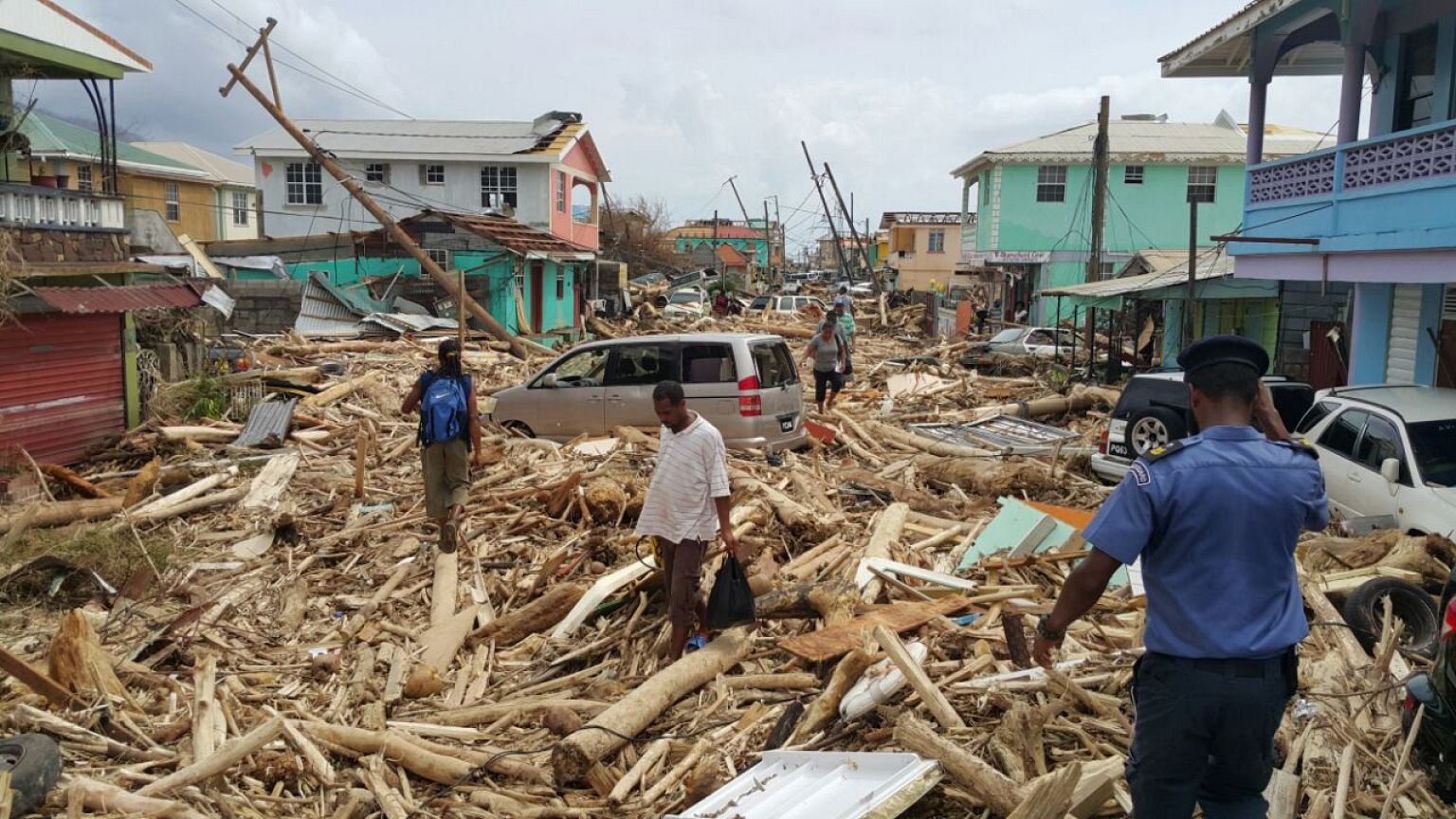
Some hurricanes seem to hit land and then quickly dissipate, causing little damage. Others, like Harvey last year, give way to heavy rainfall and flooding. What determines which course a storm will take?
There are two factors. First, whether or not the storm keeps moving inland steadily, or whether it lingers near the coast. This is determined by the steering patterns of the larger atmosphere around it, as the hurricane is essentially carried along by the even larger weather systems around it.
Second, it depends on the kind of terrain the storm is over. In the case of Harvey, the land [in and around Houston] is relatively flat and smooth and also still near the Gulf of Mexico, so Harvey did not dissipate quickly.
You said climate change seems to be changing global weather patterns to make extreme rainfall events more frequent. Can you explain exactly what's happening?
The main reason is that warmer air can hold more water vapor. So when air rises and forms clouds and then rain, more water is released and then more water falls to the ground as rain.
But there's no evidence that climate change is making hurricanes more frequent?
There is not. Unfortunately, the existing modern records of hurricanes are only of good quality for about 60 years. Because hurricane activity varies so much from year to year, then it's [not] long enough to say for sure if there is a clear trend upward due to global warming.
There has been an enormous amount of research on whether TC numbers or strength will increase in the future because of global warming. But the results of those studies are mixed and sometimes contradictory, so we can't make a conclusive statement yet.
TC numbers?
The number of tropical cyclones (hurricanes) that occur each year, in each ocean.
I see. What exactly is the difference between a hurricane and a cyclone?
Physically, they are the same thing. They are called hurricanes in the Atlantic and in the Eastern Pacific, typhoons in the West Pacific and cyclones around Australia and India.
What causes these storms to form, and what makes them move as they do?
Hurricanes form when areas of disturbed weather — rain and thunderstorms — over the ocean start to organize into a swirling pattern. As the winds increase, they extract more and more energy and water from the ocean, thus getting stronger and larger. As for their motion, they are carried along by the larger weather patterns around them, the usual lows and highs that most people often see on weather maps.
How big can hurricanes get?
The areas of hurricanes with significant weather (winds and rain) are usually about 200 miles across. Some can be larger, as much as 300 miles. Some are quite small, only 50 miles.
Do they always swirl in the same direction?
In the northern hemisphere, they rotate counterclockwise. In the southern hemisphere, it is the opposite.
Why is that?
They get their rotation from the Earth's rotation, which has an opposite sense whether you are in the Northern or Southern Hemisphere.
Are there any exceptions to this rule?
No.
You're an expert in the use of computer modeling to study hurricanes. What have you learned from your research?
Most of my research has been about hurricane formation. We've used computer models to understand the physical processes by which hurricanes form. There are many "disturbances" over the oceans every summer, but most of them do not become hurricanes. We want to understand why some of them do.
How does computer modeling work?
Computer models attempt to simulate the motions of the atmosphere. The first step is to assemble a digital "image" of the weather right now, much the same way that a camera image is made up of pixels of many different colors. But next, it uses the laws of physics and mathematics to determine how each part of the atmosphere will change with time, as they are influenced by the other pixels around them.
Any new findings?
Our work showed the importance of moisture in the middle levels of the atmosphere, around 10,000 to 20,000 feet, in the regions where hurricanes tend to form. Higher-than-average moisture is much more favorable for hurricanes to form.
In addition to computers, aircraft and satellites, are there any new tools that hurricane scientists are now using to facilitate their research?
The new generation of satellites, such as the new GOES 16 which recently became operational, are excellent. They make it much easier to see what is going on in these storms. The other developing advance is the use of drones. There are large drones, such as the NASA Global Hawk aircraft, which is about the size of a corporate jet and can fly over a hurricane for 24 hours straight. And there are small drones that can be dropped into a hurricane out of one of the NOAA aircraft, and can get much closer to the ocean's surface than the NOAA planes (with people in them) are allowed to fly.
How about cellphones or social media — have they made any difference for hurricane research?
The National Hurricane Center and other public entities are trying to use cellphones and social media to get their messages out more effectively. But not for research about hurricanes themselves.
What's next for hurricane science ?
Many scientists these days are trying to better understand "rapid intensification," which is when a hurricane's winds increase by two or more categories in a single day. But there has been a lot of progress on that, and the computer models have become pretty good at predicting this, just as they are for Hurricane Florence right now.
The other very popular topic is how hurricane activity will (or will not) change with global warming. While everyone seems to think it will make it worse, there is no proof of that yet.
As a hurricane researcher, is there some scenario that keeps researchers up at night?
I think it does make us more aware that bad events can and will happen. But we also understand that the chances of it happening to any one place is also very small.
The National Weather Service website has a list of common misperceptions about hurricanes. What do you think are the most common ones people have?
I'm not sure about most common. But one that I think is most dangerous is that many people have the perception that they have experienced hurricane conditions before. Many people experience fringe effects of a hurricane and think they have been through a hurricane. Real hurricane conditions (sustained winds of 75 mph or higher) are actually much worse than people realize.
Any advice for people who might be in the way of Florence or another hurricane?
Follow advice from your local officials.