


The missions monitor anti-ISIS coalition aircraft in the eastern part of the country, as well as Russian activity in the west.
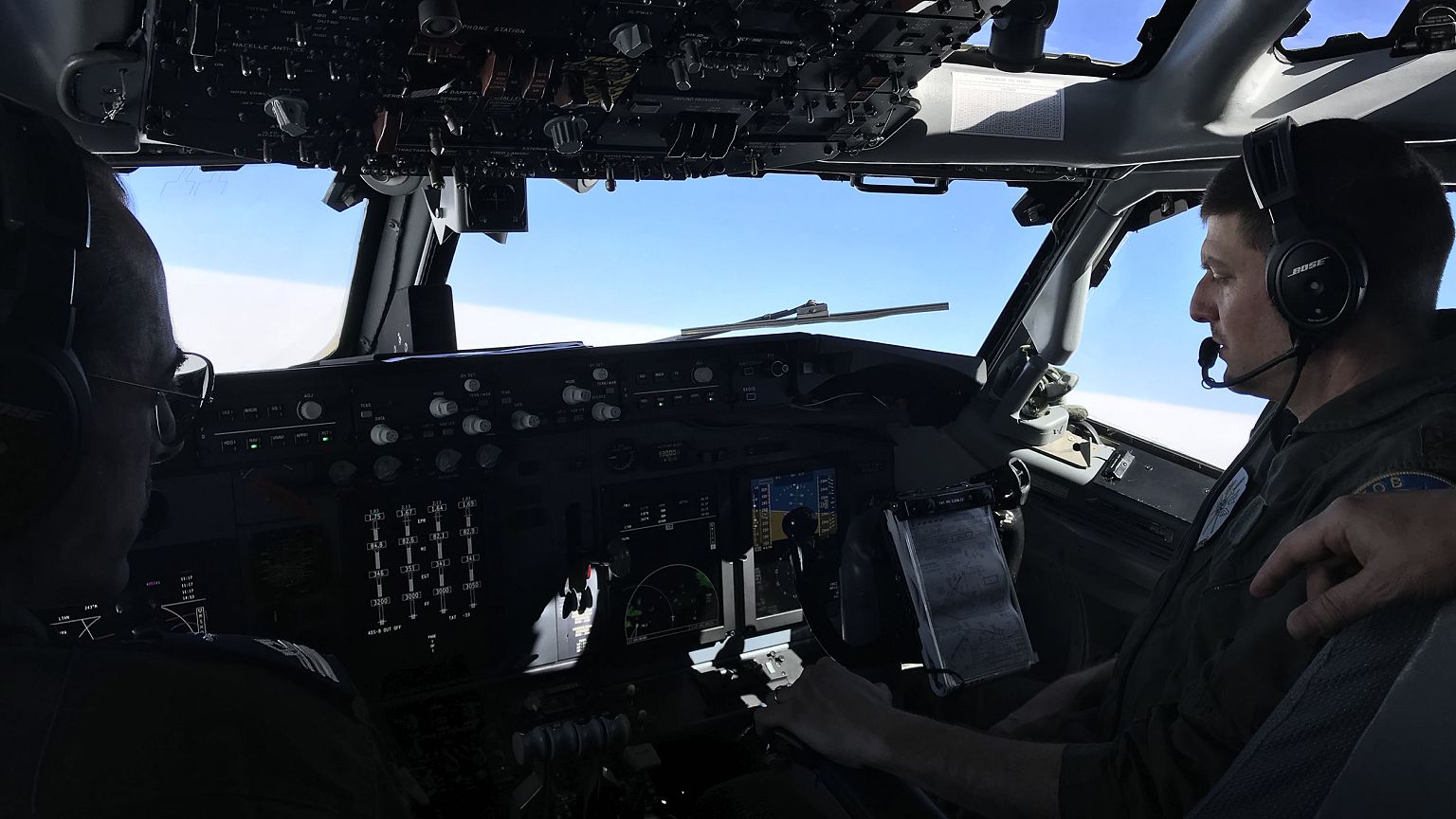
ABOARD A NATO AIRCRAFT — The smell of jet fuel flooded the cabin and a tremendous roar made it difficult to talk as a near-windowless military plane rumbled down a runway in southwestern Turkey.
Sitting along rows of computer screens under the dim overhead lights, a multinational crew of 19 monitored hundreds of miles into Syrian airspace.
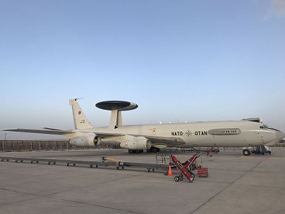
The aim of the Airborne Warning and Control System, or AWACS, is to be an eye in the sky over the Syrian war zone, a vast area covering 70,000 square miles.
During these NATO missions and similar ones carried out by the U.S. and other nations, the anti-ISIS coalition has near total visibility of Syria's aerial battlefield, military officials said.
"We have the ability to detect anything that's flying, and then process [the information], display it on our screens and then send [the data] to the ground," said U.S. Air Force Lt. Col. Christina Vile, commander of the NATO AWACS Flying Squadron 1, as she concentrated on blips on the radar screen in front of her, many within the outline of Syria's border.
During the flight, the crew monitored the activity of anti-ISIS coalition aircraft operating near the Iraq-Syria border, where the hyper-violent extremists continue to hold ground. Sporadic Russian aircraft was visible in the western part of the country.
The plane based on a Boeing 707 jetliner carries a massive radar dome on top of its fuselage, and is part of the U.S.-led coalition fighting the ISIS. While most details of these missions monitoring Syrian airspace are classified, NBC News received rare access on board the aircraft during a recent eight-hour mission.
With ISIS now driven from most of the territory it once controlled in Syria, the data collected on the flight is turned into valuable intelligence allowing allies to build a comprehensive picture of the civil war still shaking the country.
The battlefield being surveilled holds a confusing array of actors, including Russia and Iran on the side of Syrian President Bashar al-Assad, as well as the U.S. and Turkey, a NATO member that has intervened to fight advances of Kurdish fighters allied to the U.S.
While the aircraft stayed within Turkish airspace throughout the mission — flying continuous figure-eight paths just north of the Turkey-Syria border — its radar with a reach of up to 300 nautical miles monitored most of Syria's airspace, NATO officials told NBC News.
Col. Bas Pellemans explained that the surveillance aircraft give the U.S. and its allies a more complete picture than ground systems could ever provide.
"If you look at it from above, you can see much more, especially also close to the ground, and that's something a ground station can never do," Pellemans said.
After eight hours in the air, the plane bumped down on an airstrip in an airfield in Konya, Turkey. Ground crew swarmed around the huge aircraft in preparation for its next flight.