


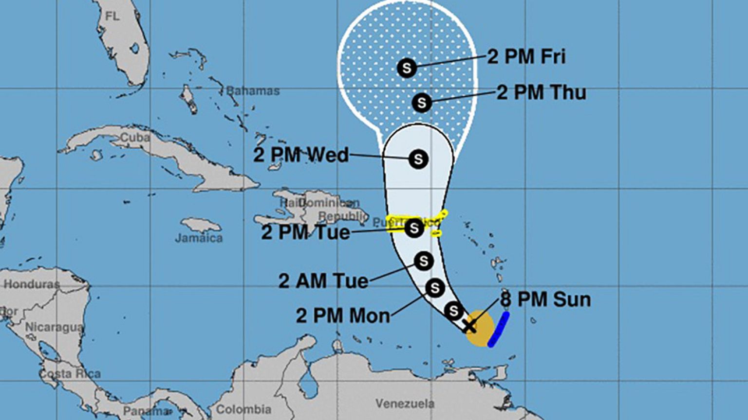
The U.S. National Hurricane Center said Karen was expected to pass near or over Puerto Rico and the U.S. and British Virgin Islands on Tuesday.
Tropical Storm Karen was slowly moving northwestward across the southeastern Caribbean Sea early Monday, while Tropical Storm Jerry was moving north-northwestward over the western Atlantic Ocean.
The U.S. National Hurricane Center in Miami said Karen, which formed on Sunday, was expected to pass near or over Puerto Rico and the U.S. and British Virgin Islands on Tuesday. Ken is around 160 miles west of St. Vincent and 315 miles south-southeast of St. Croix, with top sustained winds of 40 mph.
Meanwhile, Jerry is expected to pass near Bermudaon Tuesday night. Jerry's top sustained winds are near 65 mph with gradual gusts. The storm is around 365 miles south-southwest of Bermuda.
"Interests in Bermuda should monitor the progress of Jerry," the NHC said in a statement. "On the forecast track, the center of Jerry is expected to pass near Bermuda late Tuesday."