


Global warming is crimping the ribbon of air that controls weather systems in the Northern Hemisphere, intensifying extreme weather around the world.
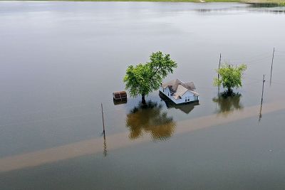
An oppressive heat wave baked Western Europe this week, setting record high temperatures in France, Germany, Poland and the Czech Republic. In India, a severe drought has choked water supplies in the city of Chennai, exposing its 9 million residents to a major shortage. And after the United States' wettest 12-month stretch on record, towns across the Midwest and the Great Plains are reeling from devastating floods.
The reasons behind these extreme weather events are complex, but scientists believe they have a common trigger: profound recent changes to the jet stream, a ribbon of fast-moving air that flows from west to east over the Northern Hemisphere and controls weather systems.
The jet stream is powered by temperature differences between the cooler polar region to the north and warmer air masses to the south. As it circles the planet, this river of air can become rippled in places. The resulting troughs and ridges can create unusual weather patterns, amplifying cold snaps in one region and intensifying blasts of heat in another, said Jeff Masters, co-founder and director of meteorology for Weather Underground, a commercial weather service headquartered in San Francisco.
When the jet stream dips south, polar air fills in the trough, bringing heavy rains and cooler-than-usual temperatures, as has happened across much of the United States with a record-late arrival of spring and above-average precipitation. When the jet stream bulges northward, warmer air rushes into the ridge, leading to hot, dry conditions, as has happened this week in Europe.
Seasonal variations are normal, but since the early 2000s, as the planet has warmed, the jet stream has been behaving strangely. Jet stream winds, which naturally undulate, have become even more gnarled, and the big wavy patterns sometimes slow to a crawl, or even completely stall.
"The winds are actually slowing down, and it's a very wiggly snake now," Masters said.
A sluggish jet stream is cause for concern. When it slows or gets stuck, high- or low-pressure weather systems that correspond to the jet stream's ridges and troughs intensify, stretching out rainy episodes, heat waves or droughts for days — or even weeks — at a time. Studies suggest that climate change is driving these new patterns, which means extreme temperatures could be more common in the future.
A pattern emerges
Unusual jet stream behavior has been recorded every three to five years since 2000 — in 2003, 2006, 2010, 2015 and 2018 — turning what scientists initially thought could be an isolated abnormality into what appears to be a pattern, Masters said.
"In all of those years, we had summers with extreme conditions — both heat waves and floods that hit different parts of the globe at the same time," he said. "We're seeing the same pattern now. It doesn't look like an anomaly anymore when you get these recurrences over and over."
What is surprising to scientists now is that the wavier-than-normal jet stream has returned for a second year in a row — the first time that has been observed, said Kai Kornhuber, a climate scientist at The Earth Institute at Columbia University in New York City.
"I wouldn't have expected this situation to return so quickly after the extreme summer last year," Kornhuber said. "It gives me the chills to see this evolving in real time again. It's a really worrying development."
Environment
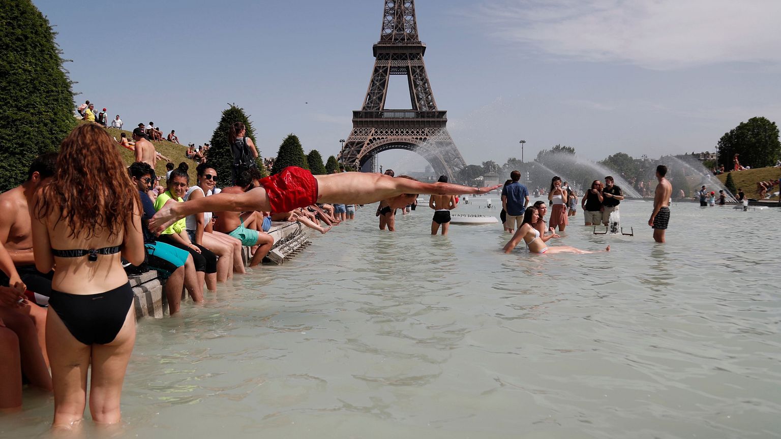
A slow-moving northward bulge in the jet stream has been blamed forEurope's current record-breaking heat wave, which saw France hit its highest-ever temperature of 114.6 degrees Fahrenheit (45.9 degrees Celsius) and caused major wildfires in Spain.
A similar jet stream wiggle caused a rare heat wave in the western U.S. in early June, with temperatures in Northern California climbing into the triple digits.
In April, Kornhuber co-authored a study published in thejournal Environmental Research Letters that linked last year's extreme weather — which included heat waves across North America and Western Europe and devastating floods in Japan — to a stalled wave pattern in the jet stream. And six months before that, he collaborated on a study published in thejournal Science Advances that used climate projections to show an estimated 50 percent increase this century in extreme weather events driven by changes to the jet stream if carbon emissions are left unchecked.
The role of climate change
As the Earth warms, the temperature difference between cooler and hotter parts of the globe, which powers the jet stream, is slowly erased.
"The Earth is not warming everywhere at the same speed," Kornhuber said. "The Arctic, at high latitudes, is warming twice as fast in the summer than other regions, which is producing favorable conditions for a very wavy jet stream."
Since the jet stream is the primary engine behind weather systems in the Northern Hemisphere, perturbations to its flow carry far-reaching risks.
"Everywhere is vulnerable and we're starting to load the dice more with slow-moving and meandering jet stream patterns," said Steve Vavrus, a senior scientist at the Nelson Institute Center for Climatic Research at the University of Wisconsin-Madison. "Extreme weather events are becoming the new normal and they are lasting longer than they have in the past."
Vavrus pointed toHurricane Harvey, which pummeled Texas in August 2017, as a prime example of the potential consequences. Harvey made landfall as a Category 4 hurricane, then weakened into a tropical storm and stalled over the area for six days, dumping a record 50 inches of rain on Houston and the southeastern parts of the state.
Significantly reducing the world's carbon emissions would slow global warming and return the jet stream to its more typical speed and pattern, according to Vavrus.
But without decisive action to address climate change, global temperatures could increase by more than 5 degrees Fahrenheit (2.8 degrees Celsius) by 2050. Within that time, the planet could undergo drastic changes, such as an ice-free Arctic Ocean in the summers and other scenarios that would significantly weaken the jet stream.
Yet, as recent heat waves and deluges have shown, the effects of climate change are already having an impact.
"I don't think we really have to look into worst cases," Kornhuber said, "because unfortunately the most likely case is already bad enough."
Want more stories about the environment?
- Without swift action on climate change, heat waves could kill thousands in U.S. cities
- Your clothes are secretly polluting the environment. Here's why you should be concerned.
- Disturbing survey reveals 414 million pieces of plastic debris on remote islands
SIGN UP FOR THE MACH NEWSLETTER AND FOLLOW NBC NEWS MACH ON TWITTER, FACEBOOK, AND INSTAGRAM.