


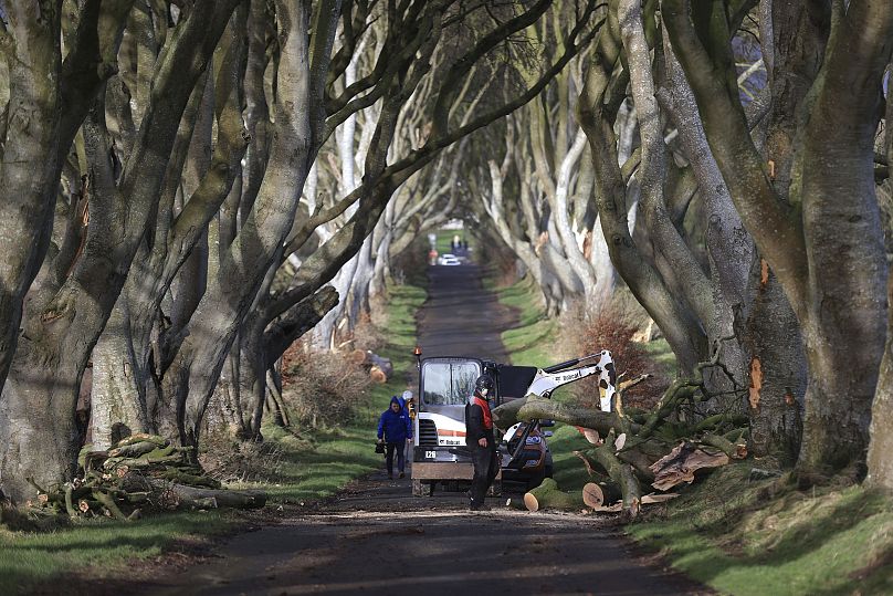
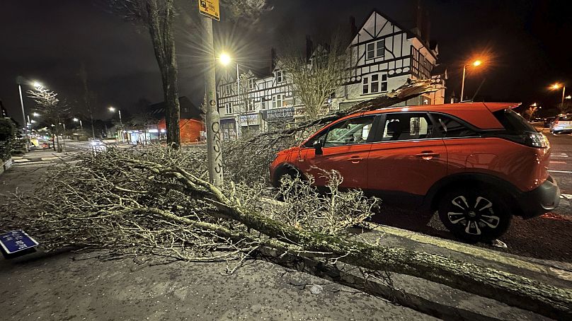
Storm Ingunn follows back to back storms that have battered the UK and Ireland this winter.
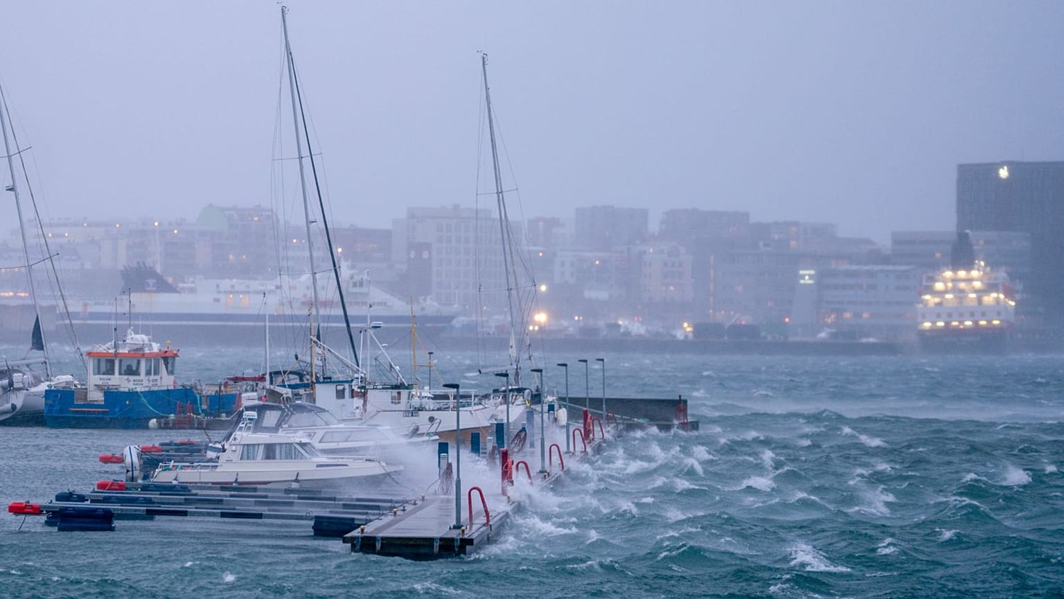
Norway is reeling from its most powerful storm in more than 30 years, which left some residents without power.
Hurricane-force winds up to 180 kilometres per hour (kph) hit central parts of the country particularly hard yesterday, leading to flooding and widespread travel disruption.
Named Ingunn by Norwegian meteorologists, the storm developed from a very powerful jet stream racing across the Atlantic. This “explosively deepened an area of low pressure” which pounded the Scandinavian country from Wednesday afternoon, the UK Met Office’s Aidan McGivern explained.
“Norway is used to windy weather, and deep lows, but this is something else,” he added. Red warnings were put in force by the Norwegian Meteorological Institute - its highest alert. Ingunn is the strongest storm since the country's 1992 New Year’s hurricane.
The UK was spared the full ferocity of Storm Ingunn, after experiencing its 10th named storm of the season last week. Storm Jocelyn followed hot on the heels of Storm Isha with wind speeds of up to 156 kph.
Unsurprisingly, many across the UK, Ireland, Norway, Sweden and other storm-hit European countries will be wondering whether climate change is partly to blame.
Is climate change causing more storms?
“This is the furthest through the list we have ever been at this stage,” a Met Office weather service spokesperson confirmed to Euronews Green last week, referring to the alphabetical lists used to name UK storms. But since storms only started being named in 2015, it’s not the best way of measuring climate change impacts.
“It's quite a complex issue and not quite as simple as [the] increasing frequency of heatwaves in the UK as a result of human-induced climate change,” they added.
Britain's average since 2015 has been six or seven storms a year. The first winter after naming began topped out at 11 with Storm Katie. The 2023/24 season could well surpass that - but it’s not so significant in the scheme of things. Winter 2013/14 was the wettest on record and the stormiest for two decades.
In the recent climate, there is no evidence of positive or negative trends in windstorm number or intensity, the UK's Met Office says. Trends in storm numbers are difficult to detect due to how they naturally vary year-to-year and decade-to-decade.
That is set to change, according to most climate projections.
Scientists predict that winter windstorms will increase slightly in number over the UK and other European countries in the coming years.
Attribution studies can indicate how much more likely and intense a particular weather event was due to climate change. But windstorms don’t tend to get prioritised for this sort of scrutiny.
Why have there been so many storms this year?
The factors that cause storms to form and be maintained are complex. One of the main drivers is a powerful jet stream - a core of strong winds around 10 km above the Earth’s surface, blowing east to west across the Atlantic.
It is influenced by the temperature difference between the pole and the equator. In the past few weeks, bitterly cold Arctic winds have caused a big contrast, leading to a stronger jet stream.
That shapes areas of low and high pressure nearer the surface which translate into stormy weather.
The El Niño weather phenomenon is also having an impact, meteorologists say, as it did in 2014 to 2016 when the UK experienced so many storms.
Warmer-than-average sea surface temperatures in the Pacific brought by El Niño have knock-on impacts across the world. In northern Europe, it typically brings wetter and windier weather at the start of winter before temperatures drop towards the end.
The relationship between this naturally occurring climate phase and the climate crisis is a subject of ongoing scientific research. But scientists are clear that the impacts of each El Niño are getting ever stronger as the climate warms - meaning more extreme weather.
Is climate change making UK storms worse?
As with frequency, meteorologists are cautious about stating unequivocally that windstorms are getting stronger as a result of rising temperatures.
But it’s clear that climate change is making storms more impactful in various ways.
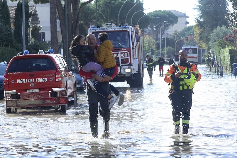
For one thing, the crisis is influencing the increased rainfall seen in extreme events - like Storm Ciarán in November.
“The reason being is due to every 1 degree of warming we experience, the atmosphere is able to hold 7 per cent more water vapour and therefore we see an increased chance of heavy rainfall associated with rainfall events,” Dr Melissa Lazenby, a lecturer in climate change at the University of Sussex, explained.
Windstorm impacts from storm surges and high waves in coastal areas are also set to worsen as sea levels rise.
And here’s what experts say about intensity. “When we see a storm, it's likely to be more intense because there's more energy in the atmosphere,” says Clare Nasir, a senior broadcast meteorologist at the Met Office. “We know that the Earth is warming up, and that's heat energy. And that heat energy translates into the atmosphere in lots of different ways, including storminess.”
“Climate change is warming both our oceans and our atmosphere, providing more fuel for storms to form and intensify, resulting in heavier downpours,” Ben Clarke, a researcher for World Weather Attribution at Imperial College London, previously told us.
How are storms named in Europe?
European countries group together to track and name their extreme weather events. For the UK, Ireland and the Netherlands, storm names are decided by the Met Office, Met Éireann and the Royal Netherlands Meteorological Institute (KNMI) respectively.
Storms are named alphabetically avoiding the letters Q, U, X, Y or Z to conform with international standards. The names come from the list published at the start of each season in September, which usually alternates between male and female options.
The public can submit names, and some are also chosen by the agencies in honour of esteemed weather experts and scientists.
These weather heroes include Ciarán Fearon, a Northern Ireland Department of Infrastructure worker, who works closely with local communities to keep people safe. And Dame Jocelyn Bell Burnell - an astrophysicist who discovered the first radio pulsars in 1967.
Kathleen is the next name on the list, another Irish submission in reference to two women: Kathleen McNulty and Kathleen Lonsdale, a computer programmer and crystallographer respectively.
It could be a little while before their storm namesake appears though, as forecasters are currently predicting calmer weather patterns for the start of February.
Norway, Sweden and Denmark name storms as a separate northern group.
Why are storms named?
“Naming storms helps to ease communication of severe weather and provides clarity when people could be impacted by the weather,” Met Office head of situational awareness Will Lang explained.
There is no strict set of criteria that the trio of agencies apply to name a storm. They take into account the potential impact of a storm system - assessing whether it could cause flooding, for example.
And as the meteorologists peer into a stormier future, they’re clear that broader climate adaptation is needed too.
"The message is we've got to start future-proofing, basically because this is not going to go away in terms of whether it's extreme in one sense or another,” says Nasir. “We're in a different landscape to what we were 30 years ago."