


Khan had called for talks between the two nuclear-armed rivals in a televised address on Wednesday, saying: "Considering the nature of the weapons that both of us have, can we afford any miscalculation?"
As Pakistan Prime Minister Imran Khan plans to hand back the captured Indian pilot in a “gesture of goodwill”, Euronews looks at what the historic tension between Pakistan and India is all about and where the geographical frontiers are.
A serious escalation of tension has risen between Pakistan and India this week.
India and Pakistani troops briefly traded fire along the disputed border in Kashmir on Thursday morning, following Pakistan shooting down an Indian plane and capturing a pilot on Wednesday.
Khan had called for talks between the two nuclear-armed rivals in a televised address on Wednesday, saying: "Considering the nature of the weapons that both of us have, can we afford any miscalculation?"
On Tuesday, India entered Pakistan’s airspace to shoot down a so-called militant group training camp.
Why is there animosity between India and Pakistan and where are the geographic flashpoints?
It all stems back to when Britain ruled the subcontinent as part of its empire. Upon its withdrawal, Britain drew borders that have left a legacy of division and bloodshed. Pakistan became the new homeland for the majority of British India’s Muslims (divided into two to include East Pakistan, itself gaining independence to become Bangladesh in 1971) while Hindu-majority India was given its own independent state.
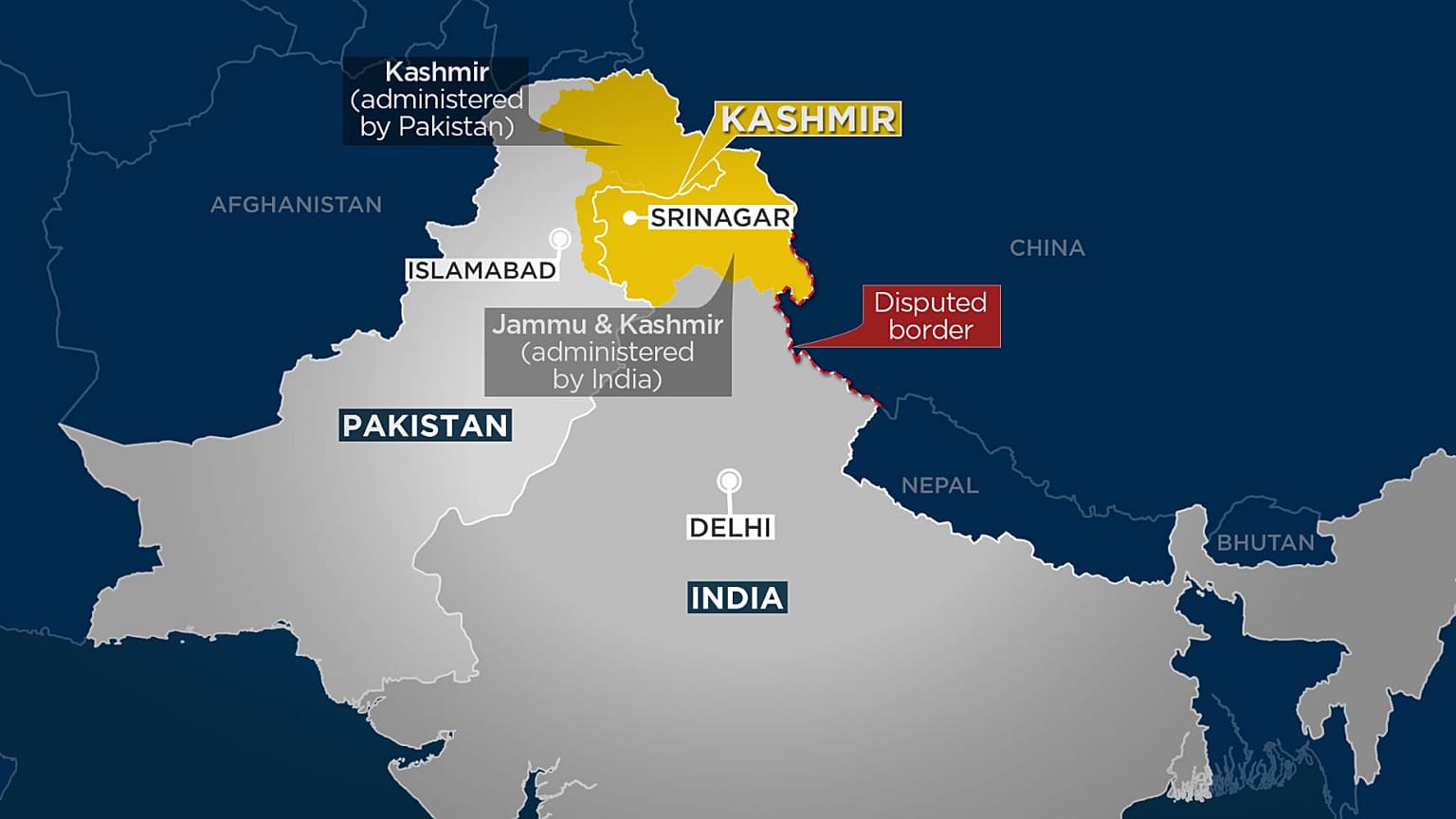
The most disputed border between Pakistan and India now runs through Kashmir.
The top map shows the region of Kasmir in yellow and where the current line of control stands (highlighted in white), which has remained as the frontier between the two foes within Kashmir.
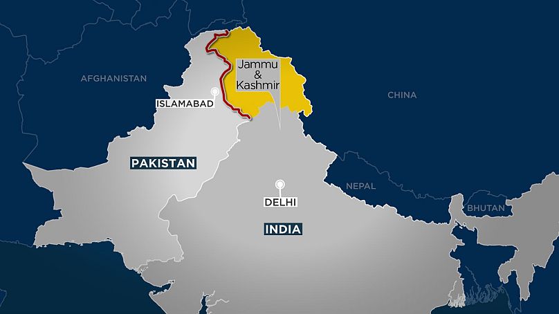
Map two (below, highlighted in yellow) shows India’s territorial claim. India currently has control over Kashmir’s capital, Srinagar after it deployed its national army and stopped Pashtun warlords taking control.
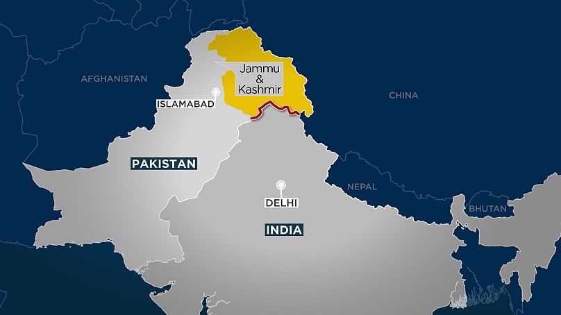
Pakistan believes it has claim to Kashmir because of the Muslim majority population living in Kashmir.
Pakistan and India have fought three wars since independence from British colonial rule in 1947 - two over Kashmir - and went to the brink of a fourth in 2002 after a Pakistani militant attack on India's parliament.
Map three (below, highlighted in yellow) shows what Pakistan claims to be its additional territory.
Further complications arise in that China lays claim to small parts of Kashmir, but these have not been added into the maps for the sake of clarity and our focus on Pakistan-India tensions.
A war hasn't erupted on the Pakistan-India Kashmir border since 1971, but residents in the area live in a constant state of alert.
India is building more than 14,000 bunkers for families in Jammu and Kashmir state close to the border, hoping to keep them safe near their homes rather than evacuate them.
Tensions come at a time when India's leader Narendra Modi is preparing to face a general election later this year.