


Brexit, it would appear, is not a new phenomenon. Scientists reveal how Britain first separated from Europe 450,000 years ago.
Geologists this week believe they’ve figured out how exactly the British isles separated from mainland Europe some 450,000 years ago.
Back then, during the last ice age, the two landmasses were connected by a chalk land bridge, the evidence of which can still be seen in the white English cliffs of Dover.
The existence of this land bridge was long accepted within scientific circles but what had happened to it remained unclear until topographical details of the English Channel emerged 10 years ago.
Researchers found evidence of a large valley system in the middle of the English Channel believed to have been caused by numerous catastrophic flooding events.
According to the research published this week and compiled by teams in the UK, France and Belgium, this is what happened:
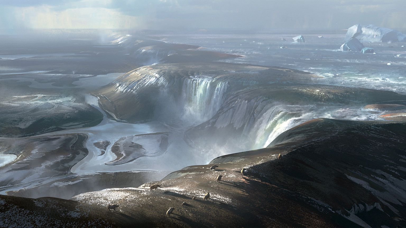
Around 450,000 years ago, a land bridge 32 kilometres long and 100 metres high created a dam between a proglacial lake in the North Sea and the dry land now submerged by the English Channel.
Earth back then was in the grips of an ice age and sea levels were lower than they are today. Researchers believe the land connecting England to France resembled frozen tundra – what we can today expect to see in Siberia.
Dr. Jenny Collier, from the Department of Earth Science and Engineering at Imperial College London, who co-authored the study published this week, said researchers are still unsure why the proglacial lake began spilling over.
“Perhaps part of the ice sheet broke off, collapsing into the lake, causing a surge that carved a path for the water to cascade off the chalk ridge,” she said. “In terms of the catastrophic failure of the ridge, maybe an earth tremor, which is still characteristic of this region today, further weakened the ridge. This may have caused the chalk ridge to collapse, releasing the megaflood that we have found evidence for in our studies.”
Topographical data shows evidence of vast waterfalls carving holes several kilometres in diameter and roughly 100 metres deep at the base of the dam. Seven of these holes, researchers say, can be found in a straight line from Calais to Dover.
Scientists believe the erosive force of these waterfalls weakened the rock escarpment and, over time, caused it to fail.
The sheer power of these flooding events, scientists say, carved out the vast valley researchers found within the English Channel a decade ago.
With the dam’s collapse, Britain would be entirely separated from the European continent as the ice age subsided and sea levels rose.
But had the dam not failed Britain could have remained attached to France much like Denmark is to Germany.
“The breaching of this land bridge between Dover and Calais was undeniably one of the most important events in British history, helping to shape our island nation’s identity even today,” said professor Sanjeev Gupta, who also co-authored the report. “When the ice age ended and sea levels rose, flooding the valley floor for good, Britain lost its physical connection to the mainland. Without this dramatic breaching Britain would still be a part of Europe. This is Brexit 1.0 – the Brexit nobody voted for.”