


These are the satellite images that show how flooding from Hurricane Dorian has ravaged the Bahamas.
These are the satellite images that show how flooding from Hurricane Dorian has ravaged the Bahamas.
The before-and-after pictures — shared with Euronews by the European land observation agency Copernicus — were taken two weeks apart by the Copernicus' Emergency Management Service team.
Satellite imagery specialist Annamaria Luongo used the Sentinel 1 radar, which allows the monitoring of the land and sea surface, despite the thick clouds of Hurricane Dorian.
You can drag the slider from left to right on the images below to see how water has flooded land on the Caribbean archipelago.
Grand Bahama
Credit: European Union, Copernicus Sentinel Data processed by Annamaria Luongo
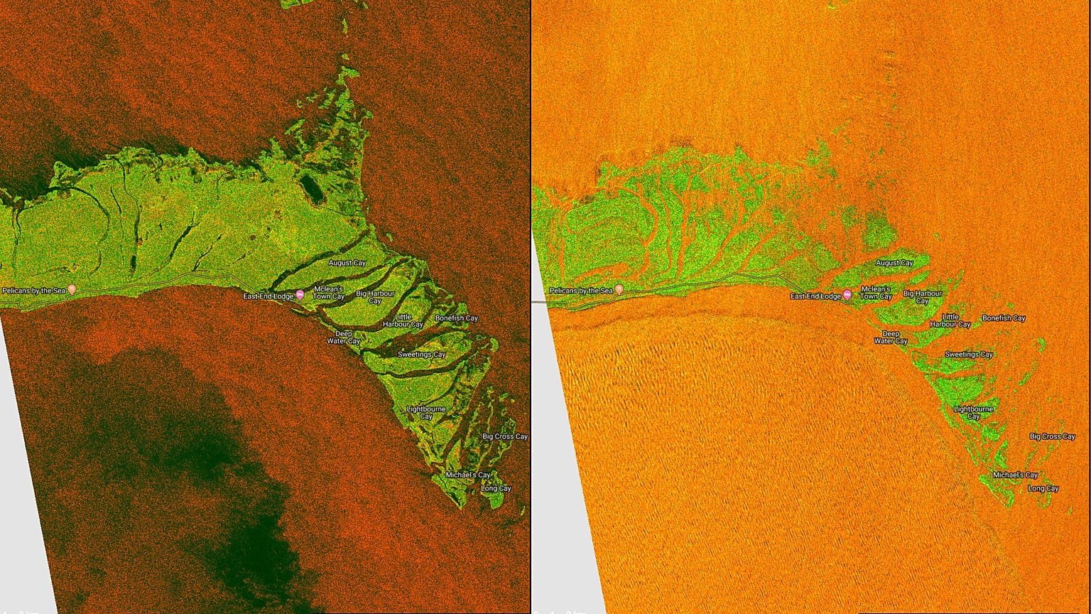
The situation was even worse in Abaco Islands, where at least five people have been killed.
Abaco Islands
Credit: European Union, Copernicus Sentinel Data processed by Annamaria Luongo
The site Windy.com is live tracking the route the hurricane is following as it approaches the coast of Florida.
It also shows a forecast for the coming days.