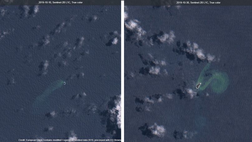
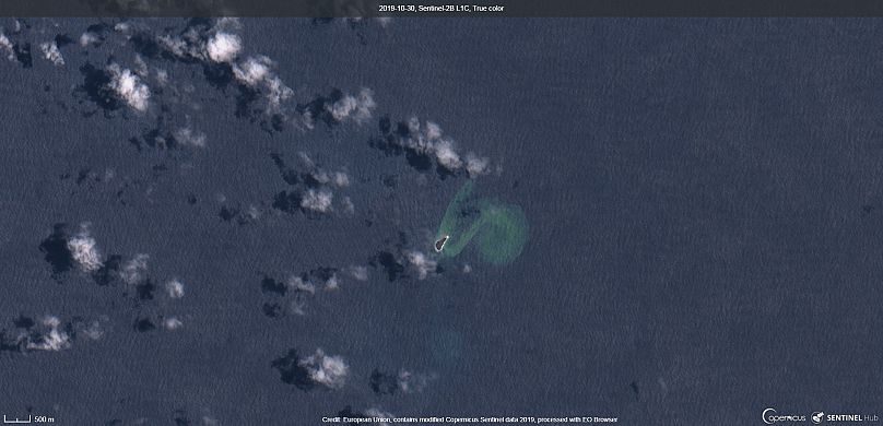
Satellite images show the moment the original island is destroyed.
Before and after images show the moment a new island is born in the South Pacific.
A massive underwater volcano swallowed up an island in the South Pacific, but created an even bigger one just three weeks later.
The eruption submerged the island of Lateiki — one of 170 that make up the archipelago of Tonga — took place 18 days ago, according to scientists.
But an island three times its size has emerged 120-metres to the west of where Lateiki once was, said Taaniela Kula of the Geological Service of Tonga.
Satellite images from the European Copernicus programme show the 100-metre long and 400-metre wide island, as well as what the area looked like before the eruption.
Copernicus also captured the moment that the volcano erupted, on October 15.
The new island is located between Kao and Late, in the Ha'apai Islands, an administrative division in the northern part of the Kingdom of Tonga.
Located 2,000 kilometers northeast of New Zealand and 650 kilometers east of Fiji, it is part of the Pacific’s "Ring of Fire" where continental plates collide frequently.
A new island formed in 2014 is already rich with sea birds and plant life.


