















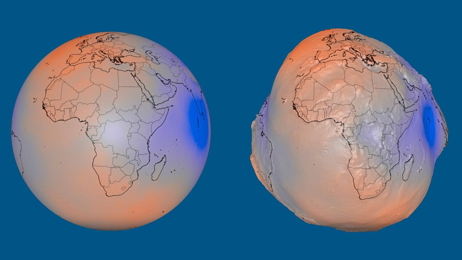













Mapping Earth’s gravity, NASA has released a visualisation of the geoid — the apparent real shape of our planet given the global ocean surface if it were exclusively under the influence of gravity and Earth’s rotation.
Gravity does not pull equally across the Earth and that has a visible impact on the shape of our planet.
 ADVERTISEMENT
ADVERTISEMENT
ADVERTISEMENT
This summer, NASA released an eye-catching visualisation reflecting these differences across Earth.
If the world’s oceans had no tides, waves, winds or currents, and were shaped only by gravity and Earth’s rotation, their surface would look slightly different. Rather than forming a perfectly smooth sphere, it would have subtle bulges and depressions.
NASA’s visualisation magnifies these differences by a factor of 10,000 making Earth appear like an uneven potato.
The geoid as it is called, a mathematical model of Earth’s gravitational field, represents an imaginary sea level across the entire planet, including beneath the continents. It is not the actual shape of Earth’s physical surface.
As mass is distributed unevenly within and across Earth, its gravitational field is also spread uneven.
Mountains, ocean trenches and differences in the density of material inside the planet all affect its gravitational field. Areas with additional mass attract water towards them, creating imaginary rises in the geoid. Elsewhere, the theoretical sea level is lower, producing depressions.
The geoid’s lowest point lies south of India
In the visualisation, variations in the geoid’s height have been exaggerated by a factor of 10,000. In reality, the difference between its highest and lowest points is 191 metres.
The geoid reaches 85 metres above the reference level around Iceland and 106 metres below it south of India. The reference level is a smooth, slightly flattened mathematical model of Earth used as a baseline for measuring these variations.
The visualisation is based on more than one billion observations collected by 19 satellites over 15 years. These include NASA’s Gravity Recovery and Climate Experiment and the European Space Agency’s Gravity Field and Steady-State Ocean Circulation Explorer.
Scientists use the geoid to study Earth’s gravitational field and how it changes as water, ice and other masses move around the planet. According to NASA, this information is also important for mapping, surveying and navigation.