From measuring gas emissions to assessing damage, the Sentinel satellites of the European Copernicus network have been providing crucial data.
More than a week after the Cumbre Vieja volcano erupted, satellite imagery has helped authorities monitor and manage the crisis.
From measuring gas emissions to assessing damage, the Sentinel satellites of the European Copernicus network have been providing crucial data.
The Copernicus' Emergency Management Service has provided daily maps monitoring the lava flow and assessing the number of properties damaged. On Wednesday, it revealed the molten rock had destroyed 656 homes and stretched across an area of 267 hectares.
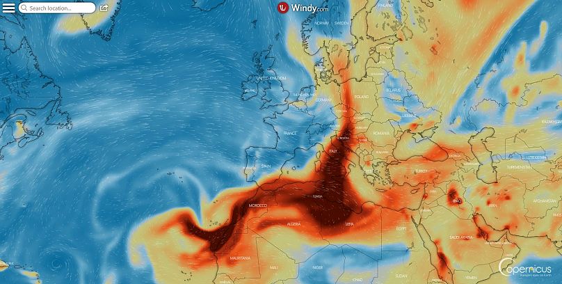
The Sentinel 5 satellite is able to detect plumes of nitrogen dioxide (SO2) emitted into the atmosphere. On Sunday the emissions reached as far as Italy. The plume is much larger but much of the image obtained by ADAM Platform is covered by clouds.
And mixing satellite data and meteorological models, the Copernicus' Atmospheric Monitoring Service is able to predict the evolution of the SO2 plume that in the coming days will reach the Arctic Ocean via southern Spain, Italy and the Balkans before heading to the Atlantic Ocean. Despite the striking concentrations shown in the Windy.com application, scientist agree that these concentrations are not harmful for health or the environment. They remain at an altitude of 5,000-10,000 metres and won't have a particular influence on air quality or acid rain.
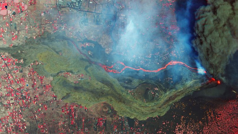
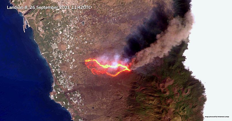
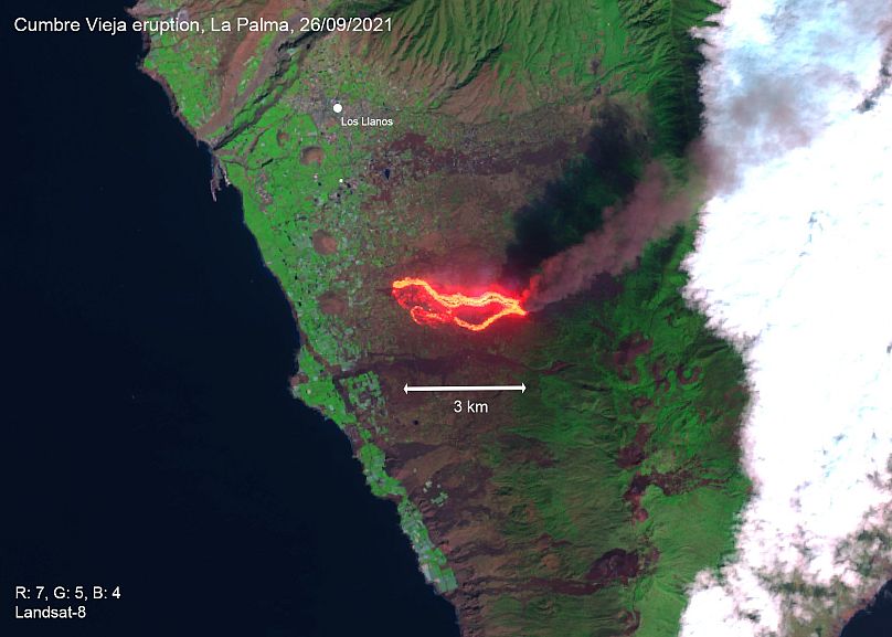
Satellites also give a clearer idea of the eruption area. Iban Ameztoy, an expert on Earth Observation tools, creates animations that allow you to "fly over" the area. Copernicus' Sentinel 2 satellite captured one of the first cloud-free images of part of the large lava flow over the weekend. Then the NASA/USGS's Landsat 8 satellite captured the full scene.
Last week, it seemed that Sicily's Etna, Europe's most active volcano, got a little jealous of its Canarian neighbour and had another new episode of explosive activity also sighted by satellites.
Satellite imaging is not an exact and predictable science. Obtaining good pictures is highly dependent on weather conditions, and earth-observing satellites only pass over a particular location every couple of days.
Another key for successful satellite imagery is the way the images are obtained and processed. Experts apply special filters to highlight aspects such as humidity or, in this case, to better see the lava flow.
Each satellite has its own specificity. The Sentinel 2 satellites are the most powerful in terms of optical capabilities.
Sometimes these spectacular images can also lead to misinterpretation. Last week when the Atmospheric Monitoring Service showed sulfur dioxide emissions from the volcano, many rushed to "warn" about a possible SO2 "cloud" that would affect Europe. Scientists had to explain that these emissions remain in the upper atmosphere and don't affect air quality. Gases from the La Palma volcano are certainly less harmful than the SO2 we generate from burning fossil fuels.
Satellite images also allow us to simply contemplate the stunning force and the terrible beauty of this natural phenomenon from a different, almost surreal angle.