


Can floods be prevented? In this episode of Smart Regions, we visit a village in the Elbe river basin, where flooding is becoming more extreme due to climate change, to learn first-hand about flood control measures co-funded by the European Union.
Döbeln is a small town in Germany, situated in the Elbe river basin near Dresden. In 2002 it suffered one of the worst floods in the last 100 years. "I went to help at a friend's house, near the river, where the water reached the first floor, there were three, almost four metres of water. It was horrible. It still hurts to remember it," says Alfred Klepzig, a resident of the municipality, with emotion.
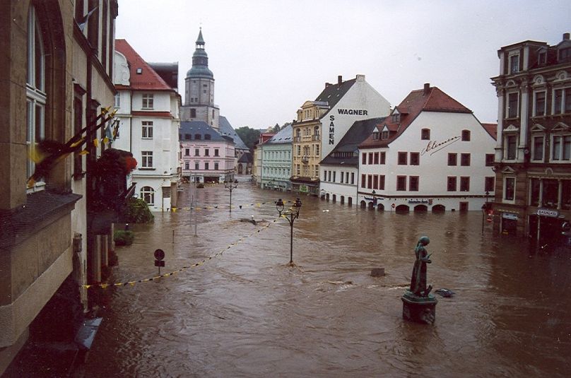
The flood of 2002 left 232 people dead in several Central European countries. In Döbeln, there were 21 fatalities, 600 buildings washed away and 300 businesses hit by water and mud. The economic losses amounted to 150 million euros. In 2013, another flood hit the area again.

The town's mayor, Sven Liebhauser, shows us the water marks that are still visible on many of the town's facades. "The water came up to here," he says, pointing to the town hall marker, "but in other places it reached 3.84 metres. Today, thanks to the flood prevention measures co-financed by the European Union, we are safer.
The centre of Döbeln is an island, two rivers completely surround the old town. One of them, the Freiberger Mulde, is a fast-flowing river and therefore floods are explosive. Unlike other towns in the Elbe river basin, once the torrential rain starts, Döbeln has only a few hours before the floods start.
"There is little margin to react and therefore the works were technically a challenge to ensure that the water does not enter from either side", says the mayor of the municipality.
How to prevent flooding on an island?
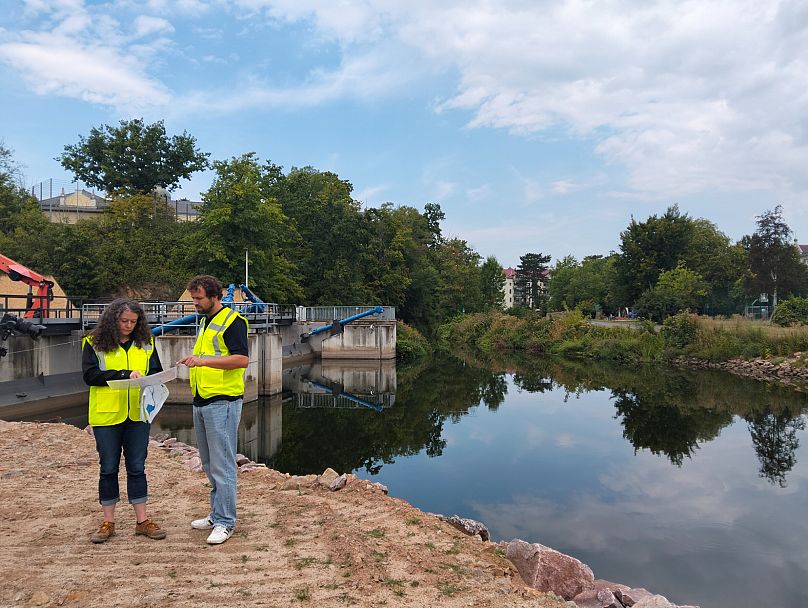
After numerous studies and forecasting models that could mitigate flooding, work began in 2009 and will continue until 2029.
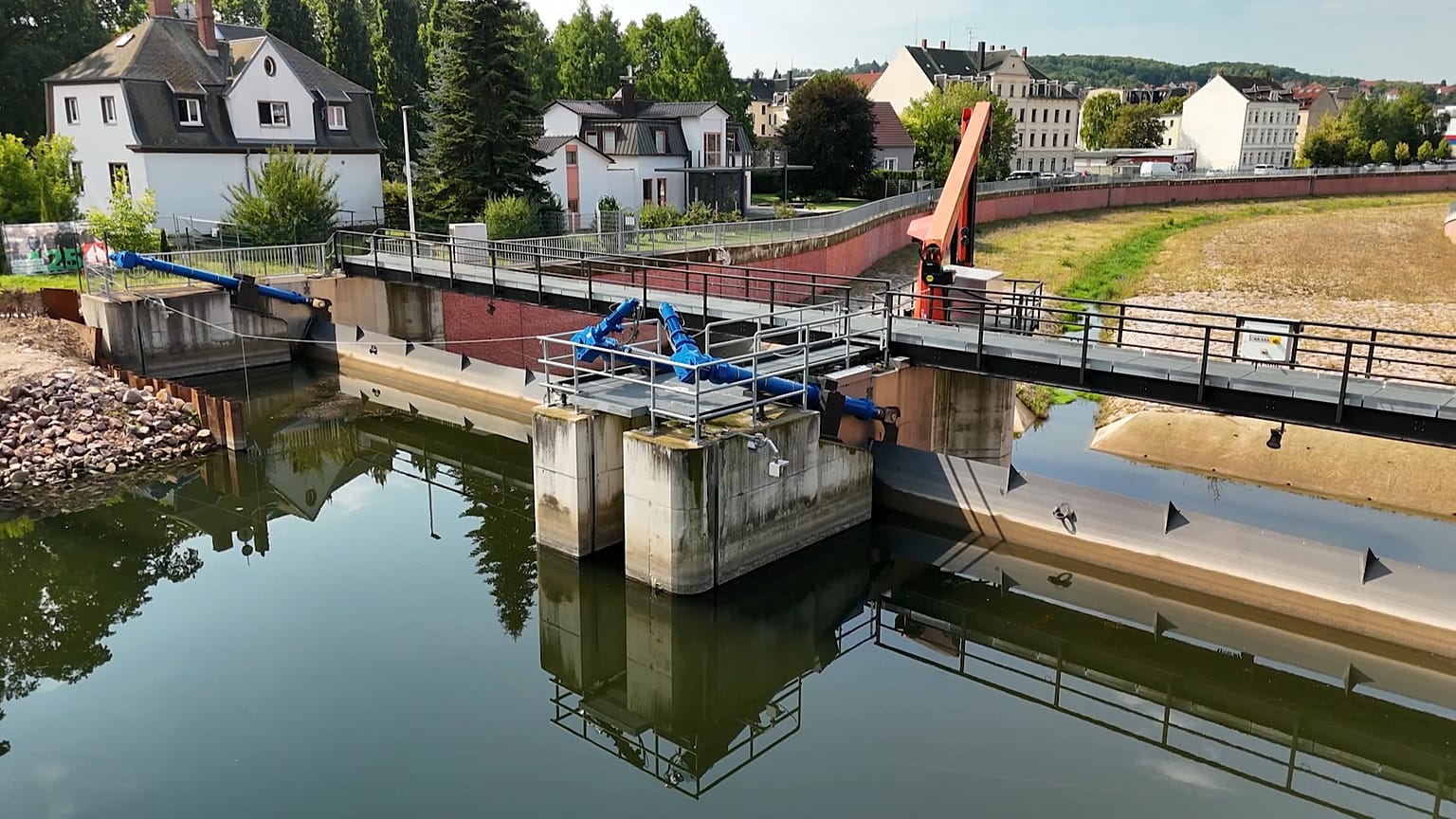
A diversion channel has been built in the smaller river. Its channel has been widened, tripling its width, to accommodate the floods. The work here was titanic: the width and length of the river had to be excavated by 2.2 kilometres, which meant demolishing several buildings, according to those responsible at the Saxony State Reservoir Administration.
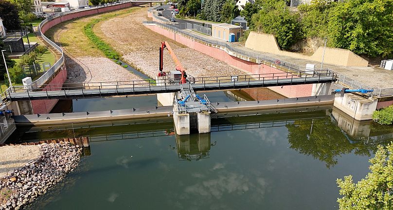
The dam, located at the confluence of the two rivers, is also key to the prevention plan. It has sensors and cameras that measure and send the water level in real time via satellite, allowing floods to be predicted. "When the flow rises, the steel gate opens fully automatically and diverts 70 per cent of the water into the artificial channel," explains Katrin Schöne, spokeswoman for the Saxon State Reservoir Administration.
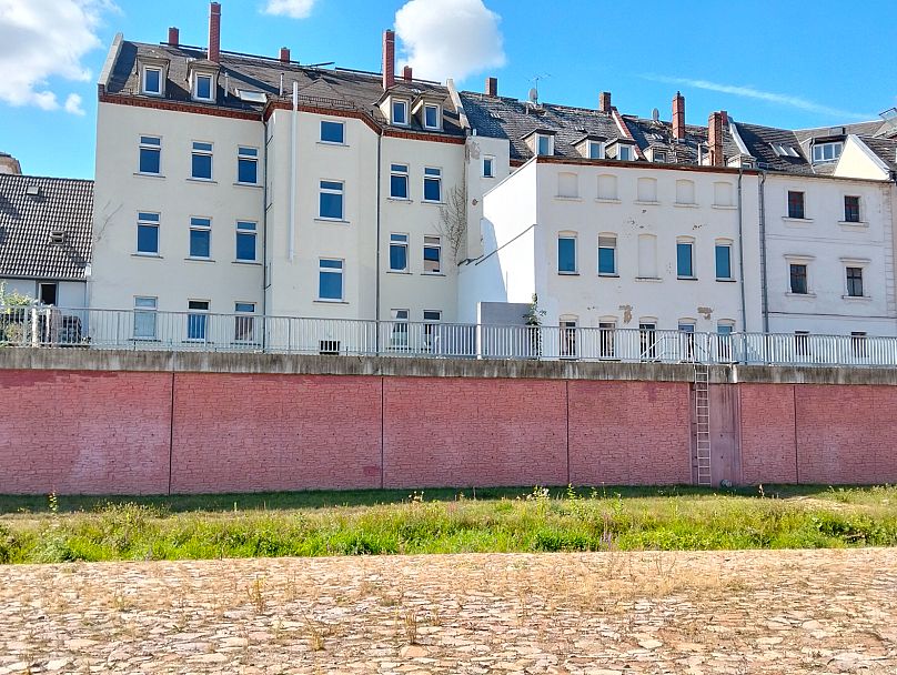
If we walk along the banks of the Freiberg Mulde, the natural river, we can see that numerous retaining walls have already been built to protect the city. It is expected that 6.5 kilometres of bank protection will be in place by the end of the works.
"On 24 December, Christmas Eve 2023, the system was put to the test: the system proved its efficiency and protected our city. Now we look to the future with more optimism, says the mayor, Sven Liebhauser. Although the works will not be completed until 2029, this infrastructure has already prevented floods from hitting Döbeln again.