


A digital tool lets users explore the Roman Empire’s road network and, using historical data, estimate how long journeys between cities took 2,000 years ago.
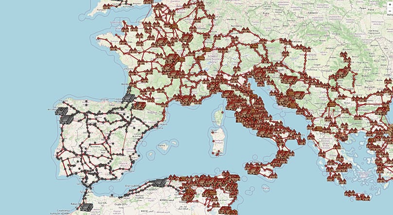
A Dutch engineer has reconstructed, with the help of academic sources and ancient cartography, the road map that linked up the Roman Empire. The result, accessible from any browser, including on mobile phones, allows users to plot routes between cities of Antiquity and find out how many days the journey would have taken on foot or on horseback.
The tool is called OmnesViae (Omnesviae.org (source in Spanish)) and is based mainly on the Tabula Peutingeriana, a medieval copy of a Roman map that depicted the cursus publicus, the Empire’s official road network.
As the western part of that document has been lost, the data for that area come from the Antonine Itinerary, another record from the Roman era. Behind the project is René Voorburg (source in Spanish), who drew on the work of historian Richard Talbert on the Tabula (source in Spanish) and on the location data from the Pleiades Project. The code and database are open access and can be consulted on Codeberg.
How it works and what it shows
The site is designed for use on a computer, but it also responds well in a phone browser. You just need to enter a starting point and a destination for the system to calculate the fastest route according to the distances recorded in ancient sources, and highlight it in yellow on a modern map.
It also provides detailed information on intermediate stops, which is particularly useful because many Roman roads followed river courses or passed close to settlements that still exist today, albeit under different names.
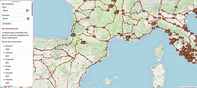
When Madrid and Milan are entered as the destination, the site identifies them as Miaccum and Mediolanvm, and marks Conplutum, today’s Alcalá de Henares, as the first major stop. Among the final stages are Avgvsta Tavrinorvm (Turin) and Placentia (Piacenza).
According to the planner’s calculation, the journey would have taken 43 days to cover 1,500 Roman miles. To put that into a contemporary context: the same route by road today can be completed in 14 days (340 hours) on foot, or 16 hours by car (source in Spanish).
A project that is still growing
OmnesViae is not the only initiative that seeks to reconstruct the communications map of the Roman world. In recent years, other projects with similar approaches have emerged, some focused on calculating travel costs and times depending on the time of year, and others aimed at documenting the physical layout of the roads more precisely using digital mapping techniques.
Voorburg keeps his tool updated and has completely rewritten the original version, which was active between 2011 and 2024, now incorporating artificial intelligence support for translations and the illustrations on the site.