


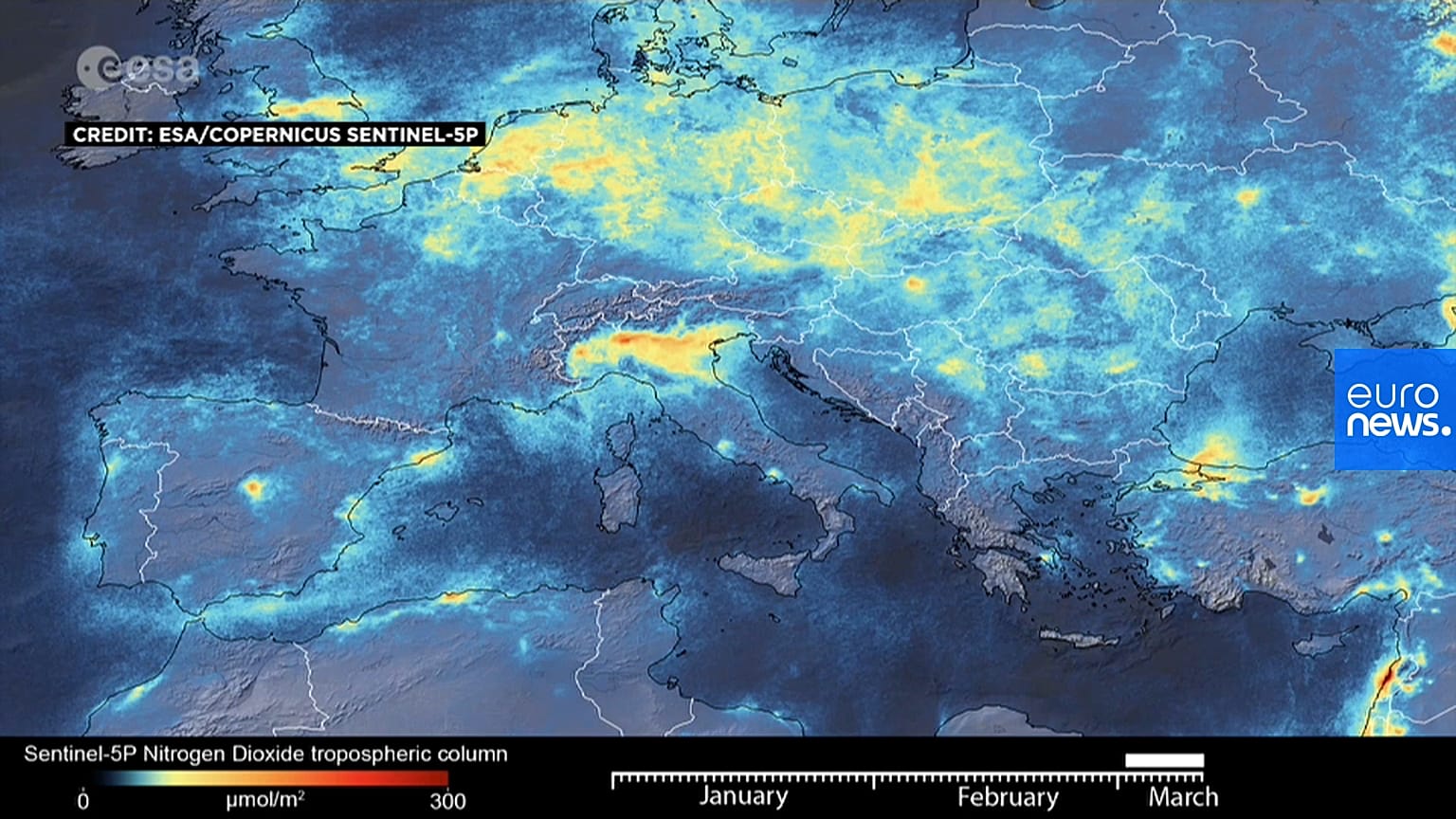
Nitrogen dioxide emissions have declined in northern Italy since its coronavirus lockdown, data shows.
Newly released satellite images show how Italy's coronavirus lockdown has prompted pollution to plummet, according to the European Space Agency (ESA).
The animation, compiled using data from the Copernicus Sentinel-5P satellite, shows a reduction in the north of the country.
Rome locked down northern towns at the centre of Italy's outbreak in late February, before extending it nationwide last week.
“The decline in nitrogen dioxide emissions over the Po Valley in northern Italy is particularly evident," said Claus Zehner, ESA's Sentinel-5P mission manager.
“Although there could be slight variations in the data due to cloud cover and changing weather, we are very confident that the reduction in emissions that we can see, coincides with the lockdown in Italy causing less traffic and industrial activities.”
The animation covers the period from 1 January to 11 March, using a 10-day moving average.
Per capita of population, Italy is the worst-hit country in the world from coronavirus. Its death rate per 1,000 infections is also the highest globally.