


European agency Copernicus Emergency Management System has provided Euronews with an animation of the ongoing wildfires in Russia's Sakha Republic.
Russian authorities continue their battle to contain the fires that have been raging in Siberia for almost two months.
Figures released by the Russian Federal Forestry Agency showed the army's efforts had reduced the area containing "active fires" to 2.5 million hectares.
However, this contradicted estimations from the environmental organization Greenpeace Russia, which said this area spanned 4.3 million hectares — a marked increase from the 3 million hectares it reported last week.
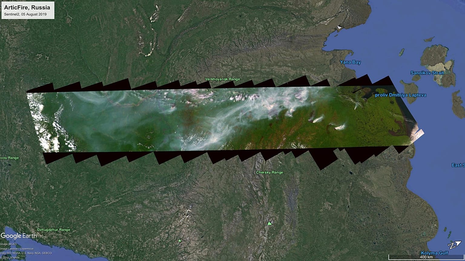
Satellite imaging expert Annamaria Luongo created an animation showing a 2,000km crosssection of the Sakha Republic that is littered with fires, which the Disaster Management Service of the European network Copernicus transferred to Euronews.
The video is made up of 41 images taken on August 5 in the 2,000-km area, which Luongo then superimposed onto Google Earth to create an animation.
You can watch the animation in the above video player.
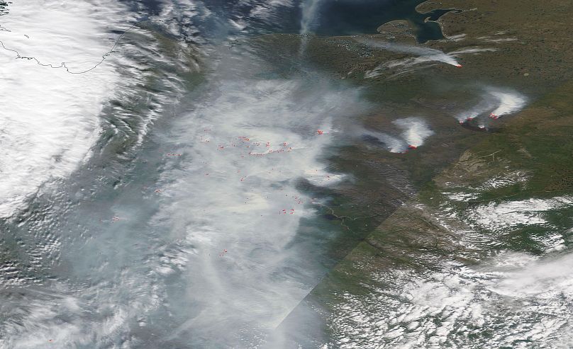
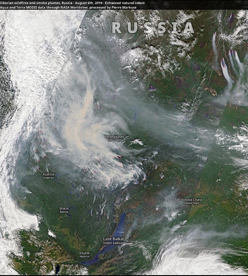
NASA's MODIS Earthview system, which highlights active fires with red dots, also showed the eastern region under clouds of smoke from dozens of fires.
Greenpeace Russia estimated that wildfires emit as much carbon dioxide as 36 million cars in a year.
While, the Copernicus ECMWF Atmosphere Surveillance Service estimated a week ago that fires throughout the Arctic, including those in Alaska, Canada and Greenland, had emitted as much CO2 in July as the whole of Colombia in one year.
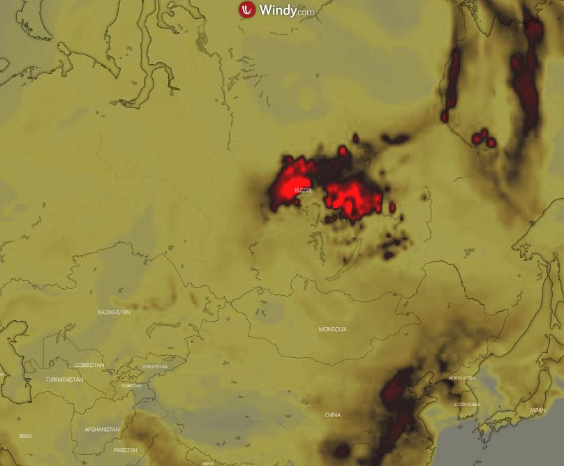
Windy.com's CO2 emissions forecast showed very high concentrations of CO2 in parts of Krasnoyarsk, Sakha-Yakutia and Irkutsk where there are wildfires.
Some of the fires in the Irkutsk region were caused by illegal logging, according to the Attorney General.
The summer fires in Siberia are part of a natural cycle, but the extent, intensity and duration of this year's fires are unprecedented, according to experts. Greenpeace criticized authorities for waiting too long to tackle the wildfires.
Further west, Lake Baikal is surrounded by fires, which satellite imaging expert Pierre Markuse showed using photos from NASA satellites.
Russian President Vladimir Putin attributed the situation near Lake Baikal, aggravated by a series of floods in the area, to climate change.
Last month, Putin used cited it as "evidence" of the challenges presented by climate change, adding that Russia's temperatures are rising 2.5 times faster than the rest of the planet.
The consensus in the scientific community is that global warming affects the Arctic twice as much as in other regions, and this summer there are examples of this, from Alaska to Greenland.