


Whether you’re looking for adrenaline-fuelled treks or more of a gentle trot with an awe-inspiring view, our pick of Azerbaijan’s top five hikes will inspire you to get your bags packed.
Azerbaijan is home to some of the world’s most dramatic hiking trails, which wind through wild landscapes, jagged mountain peaks and remote villages.
While there are routes accessible to all skill levels, it doesn’t mean they’re a walk in the park.
Hikers who make the effort are rewarded with mountaintop monuments, candy-cane-coloured cliffs and fairytale hamlets to explore.
If you’re up for an adventure, here are five of Azerbaijan’s top hikes and advice on things to keep in mind for each route from local guide Tural Mehbaliyev from Outdoor Caucasus.
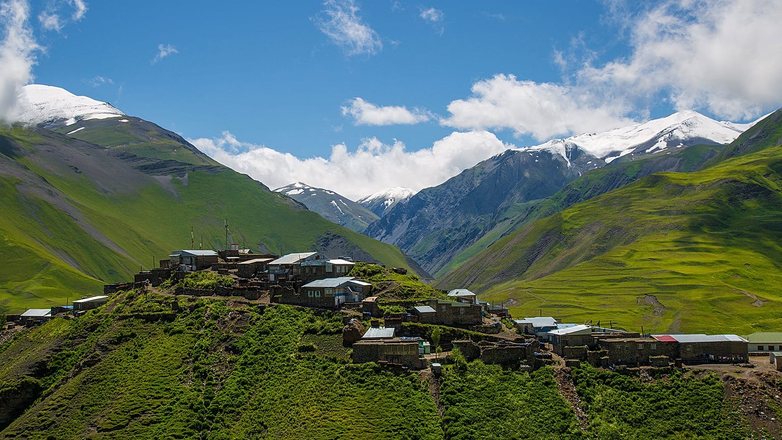
Galakhudat to Khinalig for one of Azerbaijan’s highest villages
Distance/duration: 8 km/3 hours
Head to the bewitching Caucasus Mountains for a hike through majestic scenery to one of the country’s highest-inhabited villages.
The trail starts in Galakhudat and follows an 8-km-long signposted path. The whole trek takes around 3 hours and is accessible to all skill levels.
You begin by climbing upwards from the village of Galakhadut with Bazarduzu, Azerbaijan’s highest peak, looming above you.
The main part of the route is along a wide, level road with views of the pale Gizilgaya cliffs and lush Gudyalchay valley.
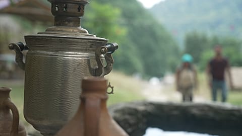
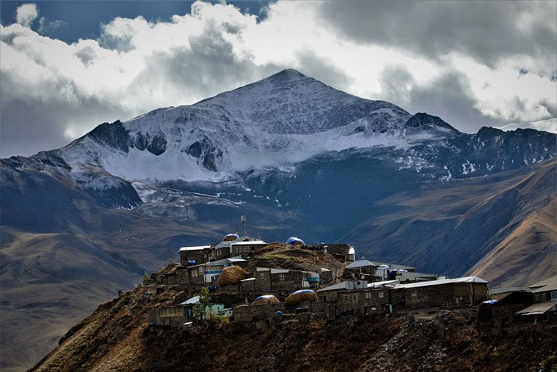
Your destination is Khinalig, also spelt Khinalug or Xinalug; a clutch of houses scattered along a rocky outcrop whose population traces its ancestry back to the prophet Noah. It is one of the oldest continuously inhabited places in the Caucasus region and residents have preserved their distinctive language and cultural practices over the centuries.
Wander around the centre, which Mehbaliyev describes as a "living museum of ancient architecture," where you'll find villagers practising traditional handicrafts like weaving, pottery and carpet-making.
Here you’ll find a small tea house serving "chai" in a traditional samovar and guest houses offering food and board.
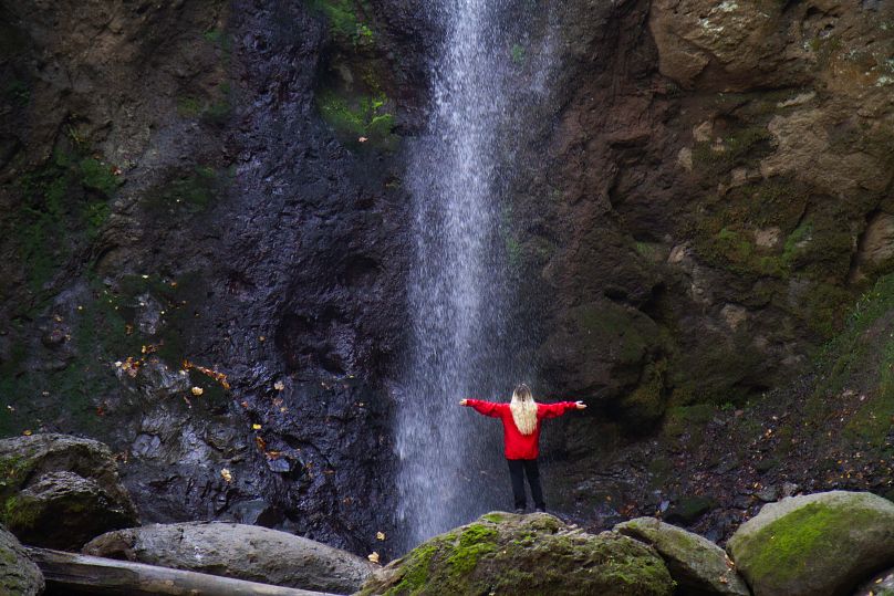
Sim village to the waterfall for fairytale forests
Distance/duration: 6.5 km/3 hours
This 3-hour trail begins in the hamlet of Sim, located in the heart of the Talish mountains. Life in the village revolves around beekeeping, vegetable growing and cattle breeding.
Sim feels like a settlement from Tolkien’s imagination with thousand-year-old trees and mossy rocks set between the houses. There is a campsite near the village and you can also stay with local families.
From here, you follow a 6.5-km-round route through Hirkan National Park. You’ll pass fruit-laden mandarin orchards and get glimpses of the glittering Caspian Sea.
The hike ends up at the Sim Waterfall — perfect for a refreshing dip after the subtropical humidity of the forest.
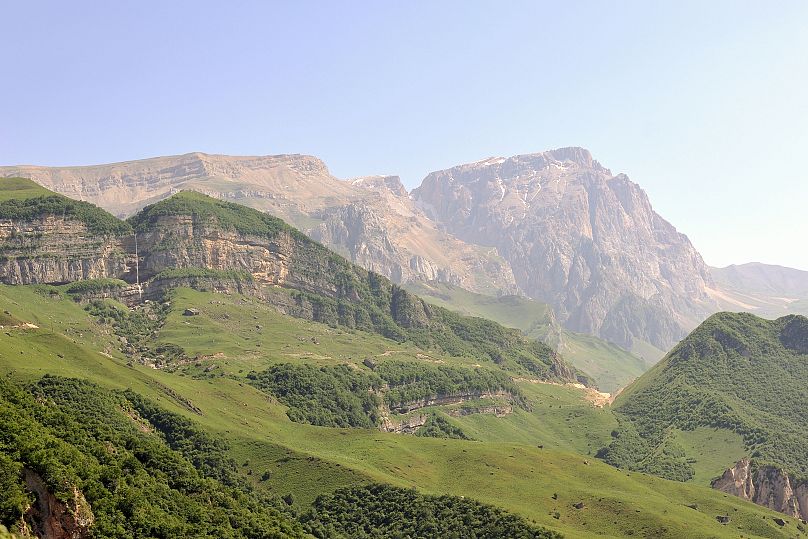
Chiragli to Javadkhan Peak Trail for majestic mountains
Distance/duration: 13.9 km/5.5 hours
This trail begins in the village of Chiragli lying on the banks of the Ganjachay river in the shadow of Mount Goshgar.
You walk most of the route along a dirt road and mountain paths. There are few trees or vegetation so you can enjoy endless views of the spectacular Mount Kapaz, Mount Goshgar and the Murov mountain range with rocky peaks that soar up all around. As with all routes, Mehbaliyev reminds hikers to stay on marked trails to avoid getting lost and prevent damage to the environment.
At the top of Javadkhan Peak is a monument to Javad Khan, the last khan of the Ganja Khanate ruling between 1786 and 1804. The sculpture is a profile of the leader with the Ganja coat of arms encircled by a spear-shaped fence.
There are natural springs in Chiragli village and en route to the destination, but there are no shops so you should bring your own provisions.
Between May and October, there might be shepherds camping in the area so hikers should watch out for dogs. "Always remember that they are trained to defend the camp and sheep," says Mehbaliyev. If you are lost or having problems, however, the shepherds can help you out.
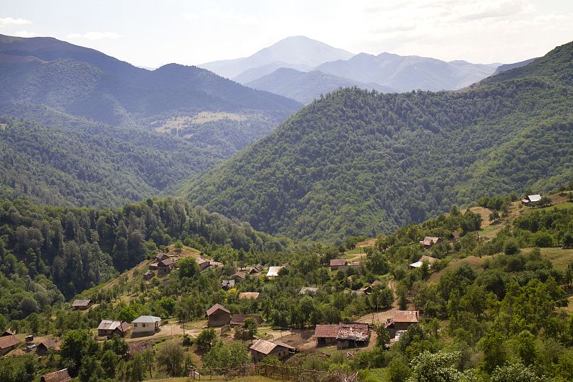
Laza to Kuzun for verdant valleys and waterfalls
Distance/duration: 6.5 km/2.5 hours
This trail links two ancient settlements in the Gusar District. It begins in the village of Laza which has plenty of long-established guest houses as well as restaurants, cafès and a grocery shop.
The route follows a mountain pass, which is lush in the summer months and dramatically snow-covered in winter. If you're considering tackling this route in the colder months, Mehbaliyev advises checking the weather forecast as conditions can change quickly in the mountains.
En route, you get a breathtaking view of the twin waterfalls thundering into the Gusarchay gorge.
You make two ascents on this hike. At the top of the first, you can soak up the view of the verdant Gusarchay valley against a backdrop of the lofty peaks of Mount Gizilgaya and Mount Shahdag.
The following kilometre takes you down into the valley before rising up again for the second ascent.
A final short descent through the thick forest leads you to Kuzun village of colourful houses inhabited by Lezgin people.
Candy Cane Mountains for surreal landscapes
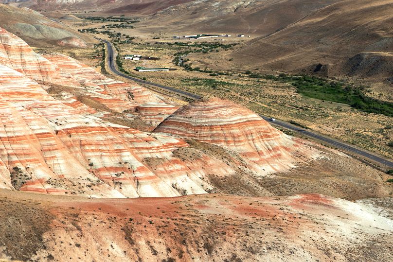
Travelling west along the Guba-Baku highway towards the mountain village of Altiaghaj, you pass through a valley of surreal beauty. On either side are undulating hills with psychedelic red, pink, orange and chalk-coloured stripes and swirls.
British travel writer Mark Elliott — who has written best-selling guidebooks on Azerbaijan — dubbed the area the Candy Cane Mountains, and the name has stuck.
The eye-catching colours are thought to be caused by layers of iron compounds in the rock which, through gradual erosion, have been exposed.
Look closely at the ground as you walk, and you might spot tiny fossilised remains of an ancient squid-like belemnite.
There are several small trails that snake through the mountains. If you are a confident hiker and you have a GPS mapping system, you might choose to explore them on your own.
Mehbaliyev recommends walking to Mount Beybayim or to Mount Beshbarmag.
"(The) main mountains are quite close to the autobahn (main road), which also gives an opportunity to park the car nearby and hike easily," he adds.
Otherwise, it’s best to take a tour or organised hike with a local company, many of which you can find in nearby Baku.
Read more