


Scientists are attempting to track 1,000 cattle and buffalo from space using GPS, AI and satellites
There is hope in northern Australia that cattle and buffalo can be tracked using satellites in space.
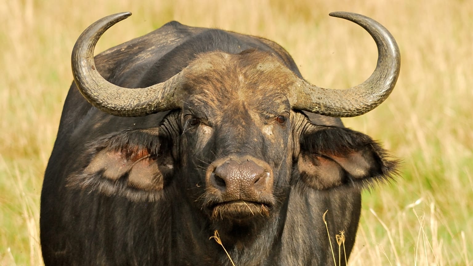
An estimated 22,000 buffalo roam free in a remote location of Arnhem Land, Australia, but no one knows the exact number.
What is certain though, is how much they destroy the environment.
“Seeing what these buffalos do to country is devastating,” said Steven Craig, who rounds up livestock.
A feral buffalo can be 188 cm tall and weigh 1,200 kg. They tend to eat up large volumes of grass and other plants, rub off rock art, trample ceremonial sites and destroy culturally significant waterways.
Together with cattle, the huge, unpredictable animal is known to be a major threat to the ecology and economy of Northern Australia.
Combining AI and satellite technologies with indigenous knowledge
What if feral animals could be managed from space?
After years of preparation, scientists are now collaborating with stockmen and Indigenous rangers in a four-year program to monitor feral animals from space.
Dubbed SpaceCows, the large-scale remote herd management system is supported by the Australian government's Smart Farming Partnership initiative and combines AI and satellite use.
Local rangers and stockmen chase and catch the speedy animals to attach solar-powered GPS tags.
The tag data are directly transmitted to a space-based satellite system at an altitude of 650 km for up to two years or until the tags fall.
In 2021, the government agency behind the program, the Commonwealth Scientific and Industrial Research Organisation (CSIRO), used Microsoft technologies to develop a foundational digital platform for SpaceCows and AI algorithms.
According to Microsoft, the satellite system, combined with its cloud service Azure, can better factor in the natural topography and harsh environment in Australia's far north than conventional wireless technology.
Microsoft technologies then create a digital twin of the land combined with terrain and weather data.
Once the rangers know where the animals tend to live, they can concentrate on conservation efforts – by fencing off important sites or even culling them.
"There's very little surveillance that happens in these areas. So, now we're starting to build those data sets and that understanding of the baseline disease status of animals,” said Andrew Hoskins, a senior research scientist at CSIRO.
If successful, it could be one of the largest remote herd management systems in the world.
"This (is a) really large-scale tracking project, probably of the largest scale from a wildlife or a buffalo tracking perspective that's ever been done,” said Hoskins.
For more on this story, watch the video in the media player above.