










Advertisement

Partner content

 Vexiza
‘Partner Content’ is used to describe brand content that is paid for and controlled by the advertiser rather than the Euronews editorial team. This content is produced by commercial departments and does not involve Euronews editorial staff or news journalists. The funding partner has control of the topics, content and final approval in collaboration with Euronews’ commercial production department.
Partner content
‘Partner Content’ is used to describe brand content that is paid for and controlled by the advertiser rather than the Euronews editorial team. This content is produced by commercial departments and does not involve Euronews editorial staff or news journalists. The funding partner has control of the topics, content and final approval in collaboration with Euronews’ commercial production department.
Vexiza

Europe sees disasters coming. Can it act in time?

©
©  -  Copyright Vexiza

Europe is getting better at observing and modelling extreme weather, but translating that information into harm reduction remains a crucial challenge.

ADVERTISEMENT
ADVERTISEMENT

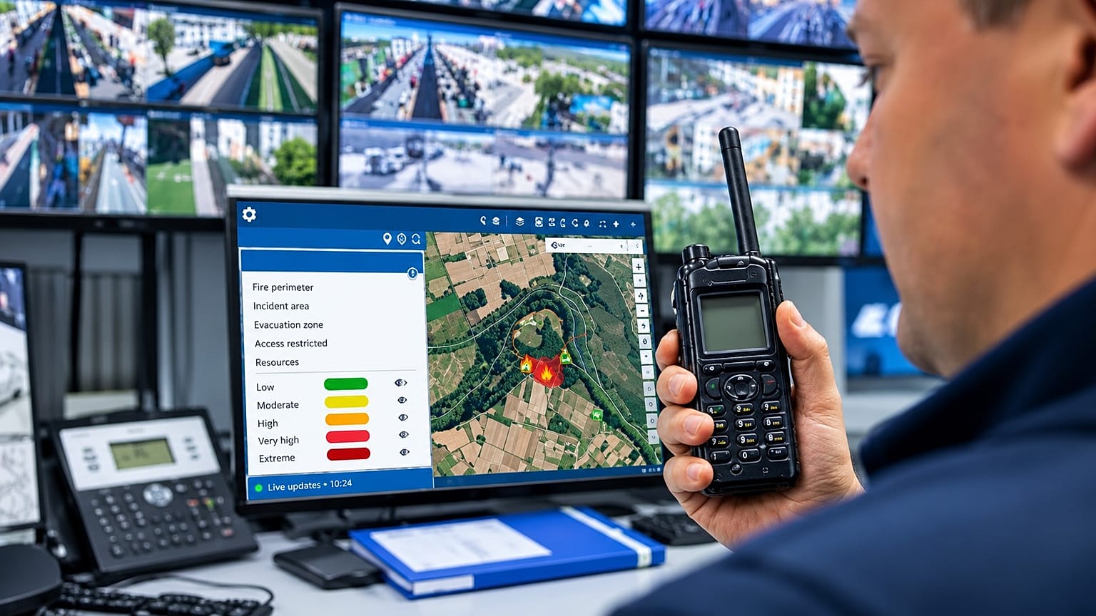
When a forest fire breaks out, heavy rain threatens a town, or high winds put power lines at risk, emergency responders need to know where danger lies, how conditions might change and where resources are needed.

As climate change heightens risks ranging from wildfires and flooding to drought and extreme heat, climate intelligence is increasingly vital to Europe’s ability to adapt.

Half of the EU was experiencing some level of drought in summer 2026. By October, wildfires had burned more than 690,000 hectares of land, an area almost twice the 20-year average.

Together, the figures highlight the scale of Europe’s climate risks and the growing need to prepare for their consequences. Europe’s challenge now is not to gather more climate data, but to make sense of what it already has, turning it into useful intelligence while there is still time to act.

Operational decisions: knowing where to act

The volume of climate data available from satellite imagery and meteorological forecasting has never been greater, but raw data alone cannot guide an emergency response.

Geographic information systems (GIS) turn these datasets into actionable maps, helping track extreme weather and flag areas at risk of wildfires, flooding and storms. They can overlay weather information with details about terrain, infrastructure and emergency resources to give responders a clearer picture of the situation.

Embedded artificial intelligence can analyse these massive, real-time datasets to identify patterns and draw out insights that might otherwise be missed. Simulations allow teams to explore how an incident might develop, helping emergency services anticipate changing conditions and prioritise their response.

The aim is not to predict every eventuality, but to give field teams better information on where danger is greatest and where to act first.
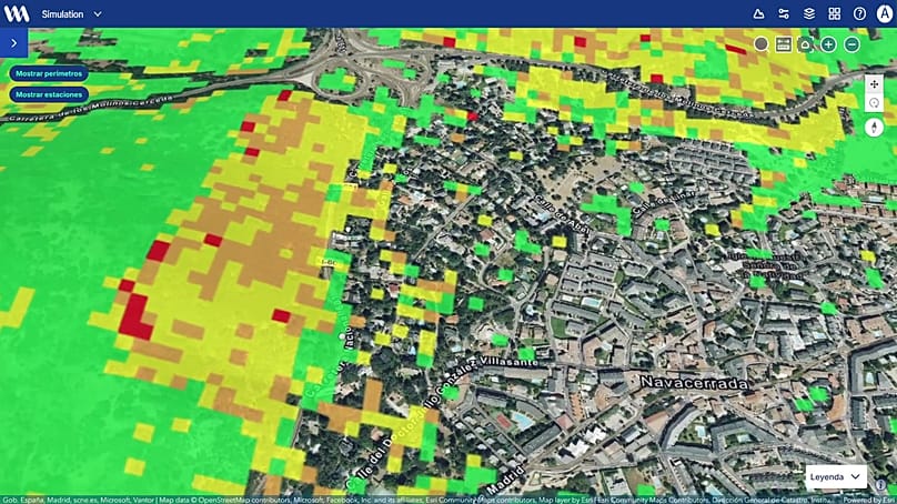
Maps and GIS visualisations showing risk levels
Maps and GIS visualisations showing risk levels © Vexiza

Case study: coordinating wildfire response in Navarre

In Spain’s Navarre region, Vexiza has developed an integrated wildfire-management system that brings resource dispatch, operational planning and fire monitoring into the regional emergency response system.

Technicians and decision-makers can access information about response teams, air and ground resources and weather conditions in one place. Simulations show how a fire might evolve over the following 24 hours, helping responders identify priority areas, assess road access and consider evacuation routes.

Vexiza’s open-access INFORCYL platform, developed for Castilla y León, also aims to make live wildfire information available to the public through an interactive map. Users can see fire locations, severity levels and the resources deployed, with explanatory text to help non-specialists understand the response.

Meanwhile, Horizon Wildfire Insights, a project supported by the European Space Agency and involving Airbus, B2Space and Vexiza, aims to integrate Earth observation data, aerial information, field reports and emergency communications to give a clearer operational picture and support a coordinated response as the emergency unfolds.

Precisely, due to this innovative proposal, Vexiza is also part of the global Santander X 100 community. This group consists of the most prominent companies within Banco Santander’s global entrepreneurship initiative, Santander X, which supports entrepreneurs and businesses in growing and transforming their operations. The community offers a comprehensive value proposition that includes training programmes, challenges, awards, benefits, discounts, access to a network of experts, and personalised financial solutions.

Preventative decisions: acting before disaster strikes

Data technologies can also help authorities prepare for extreme weather before it occurs.

While satellite imagery provides data on terrain, vegetation and climate changes, AI systems can analyse patterns across these sources, to help identify emerging risks. Scenario modelling also allows experts to explore how fires and floods might develop under different conditions, before they do.

These tools do not eliminate uncertainty or replace human judgement. They can, however, help professionals identify vulnerable areas, compare possible scenarios and prioritise preventive action, particularly when resources are stretched.

From modelling potential floodwater flows to identifying vegetation that could fuel a wildfire, climate intelligence can help authorities spot vulnerabilities early enough to act.
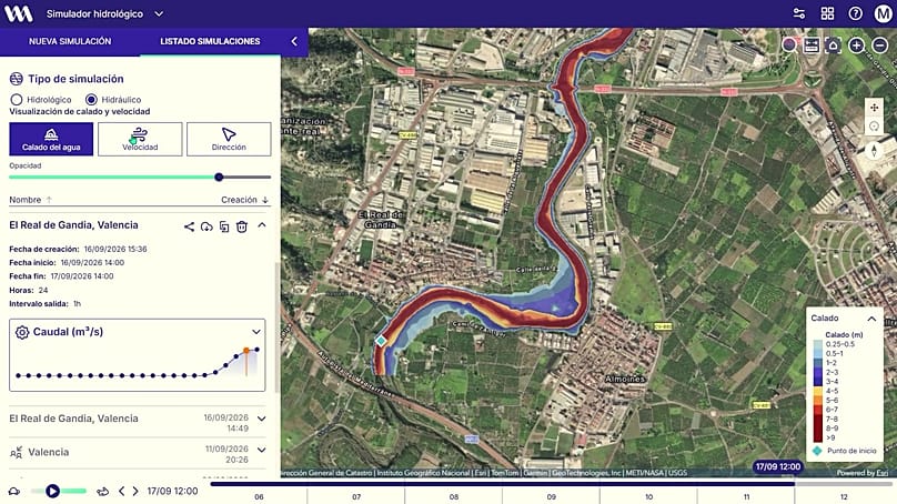
Outputs from flood simulation
Outputs from flood simulation © Vexiza

Case study: anticipating flood risk in Murcia

When it comes to flood forecasting, local context matters. Predicting heavy rainfall is one thing; understanding its potential consequences requires joined-up information on terrain, water flows, drainage and exposed areas.

In Spain’s Region of Murcia, Vexiza has developed a hydrometeorological risk monitoring platform with regional research institute IMIDA. The platform brings together weather and environmental data to help assess flood risks, particularly in rural and coastal areas, and shares relevant information with emergency services.

Prevention also means tackling hazards on the ground. Vexiza’s biomass monitoring platform, Xesbio, helps forestry authorities in Galicia track vegetation-clearance work and inspect high-risk areas. Its mobile tools allow teams to record inspections, including offline, and identify where further action may be needed.

Financial decisions: understanding what is at risk

As extreme weather increasingly affects the European economy, the need for better climate intelligence extends beyond emergency services.

Insurers, banks and energy companies share the same need to understand how floods, wildfires and other environmental hazards could affect their assets, infrastructure and financial positions.

Scenario modelling helps diverse organisations explore what could happen under different conditions. By stress-testing their operations and investments against potential severe weather scenarios, they can identify vulnerabilities and make better-informed decisions before losses occur.
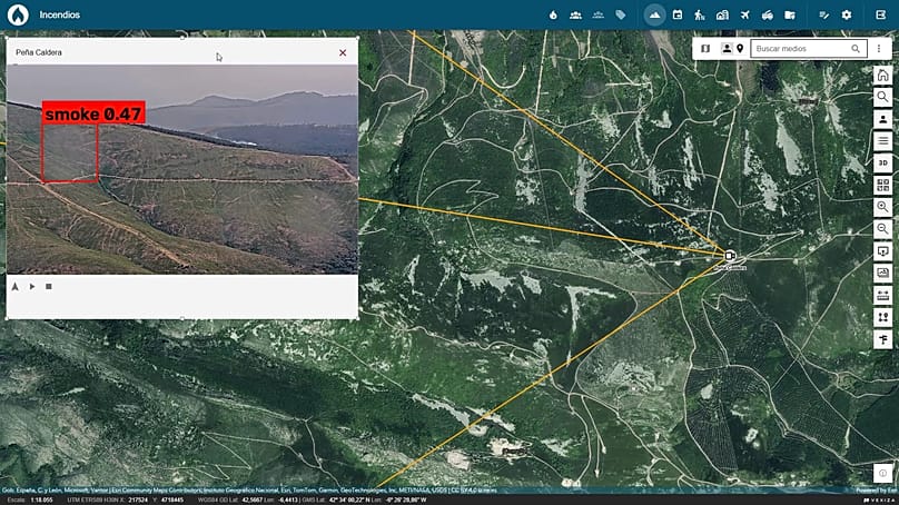
Images of AI-powered cameras
Images of AI-powered cameras © Vexiza

Case study: Santander UK stress-tests flood risk

In its 2025 Sustainability Supplement, Santander UK assessed the potential impact of three major river floods affecting London and south-east England in 2026, 2028 and 2033.

The exercise examined potential consequences for property values, infrastructure, economic activity and the bank’s mortgage portfolio, including the role of insurance in mitigating losses.

The modelling estimated losses could be 19 per cent higher than under the baseline scenario reflecting current conditions and government policies. Although hypothetical, the exercise illustrates how climate modelling can help banks explore how physical hazards and delayed climate action could affect their portfolios and inform financial planning.

Better information, better decisions?

Across emergency response, prevention and financial risk management, the underlying challenge remains how to make complex datasets useful to the people who need to act on them.

Technology cannot predict every disaster or eliminate uncertainty, but it is already helping public and private organisations understand risk earlier, make faster, more informed decisions and strengthen resilience against a wide range of climate risks.

The value of climate intelligence lies not in how much data we collect, but in how effectively we turn it into practical decisions that reduce losses and save lives.

Partner content presented by
Vexiza ‘Partner Content presented by’ is used to describe brand content that is paid for and controlled by the advertiser rather than the Euronews editorial team. This content is produced by commercial departments and does not involve Euronews editorial staff or news journalists. The funding partner has control of the topics, content and final approval in collaboration with Euronews’ commercial production department.
Share Add Euronews on Google
ADVERTISEMENT