Newsletter Newsletters Events Events Podcasts Videos Africanews
Loader
Advertisement

Before and after photos from Beirut's port reveal scale of disaster

Comparable satellite imagery shows the scale of destruction
Comparable satellite imagery shows the scale of destruction Copyright  Planet Labs Inc/AP
Copyright Planet Labs Inc/AP
By AP
Published on Updated
Share this article Comments
Share this article Close Button

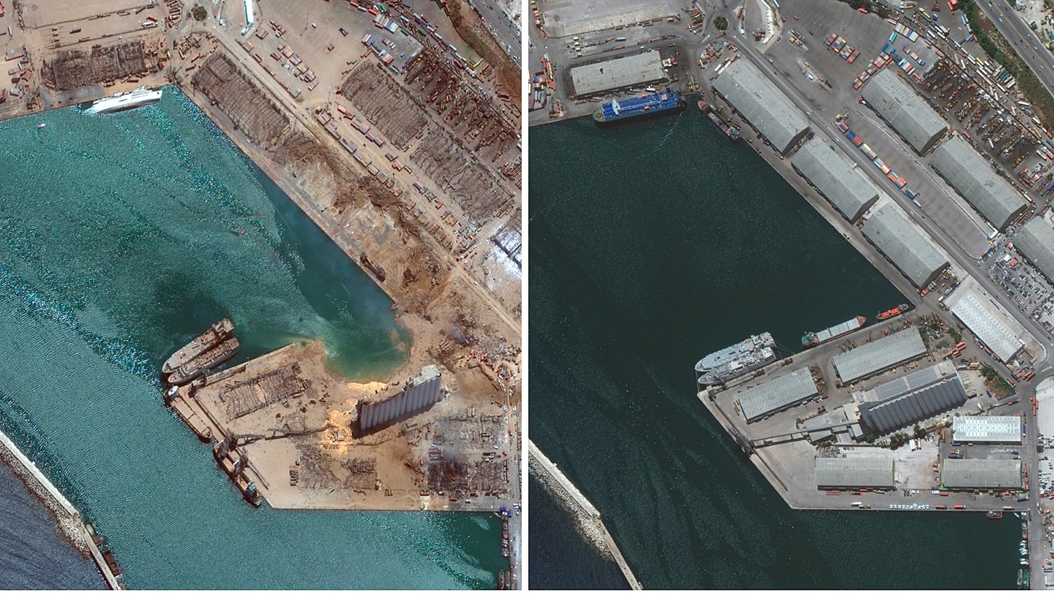
Satellite images, taken before and after the twin explosions in Beirut, reveal the sheer scale of Tuesday's disaster.

ADVERTISEMENT

Satellite images capturing before and after moments of twin explosions that rocked Lebanon's capital have revealed the sheer scale of Tuesday's disaster.

More than 100 people were killed, 4,000 wounded and up to 300,000 people left homeless after the blasts ripped through the port area in Beirut.

The destruction itself comes at a critical time for Lebanon, which was already under severe pressure from an ongoing financial crisis topped with struggles to control the spread of coronavirus.

Go to accessibility shortcuts
Share this article Comments

Read more

Beirut blast: Russell Crowe donates large sum to restaurant destroyed in port explosion

Beirut blast: Macron pledges international aid as protests erupt in Lebanon

Israeli strikes hit Beirut for the third time since November ceasefire