
The Copernicus' fire danger forecast also shows that the risk of wildfires is currently particularly acute in the areas impacted by a heatwave.
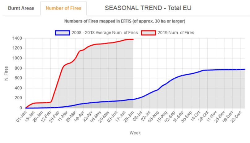
Nearly 1,400 fires have hit Europe so far this year compared to an annual average of 174 in the same period over the past ten years, data from the Copernicus programme has shown.
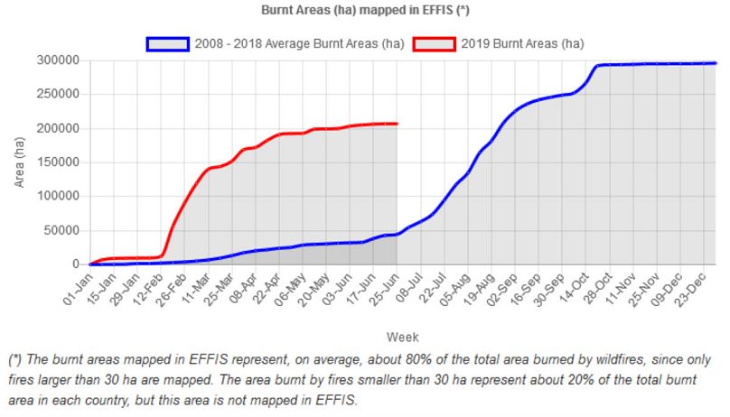
This has resulted in a near five-fold increase in burnt areas.
According to Copernicus' European Forest Fire Information System (EFFIS), blazes have so far this year burnt 207,440 hectares. In the decade from 2008-2018, an average of 44,491 hectares had burnt by June 25 every year.
The programme's fire danger forecast also shows that the risk of wildfires is currently particularly acute in the areas impacted by a heatwave.
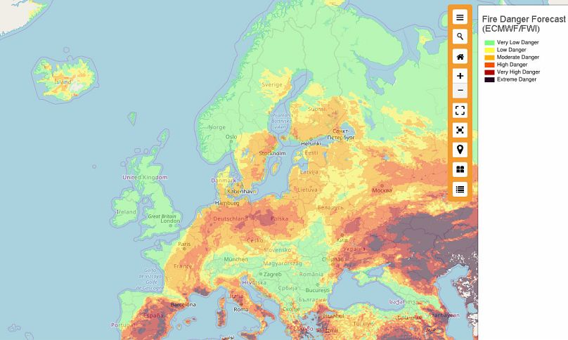
Heatwaves alone do not explain higher risk of fire. A number of conditions impact whether fires will spread and intensify.
They include the available amount of dry foliage, temperature, overall soil moisture, wind speed and the presence of potential ignition sources, which can be natural — such as lighting — or due to human activity — such as a piece of glass or a smouldering cigarette.