
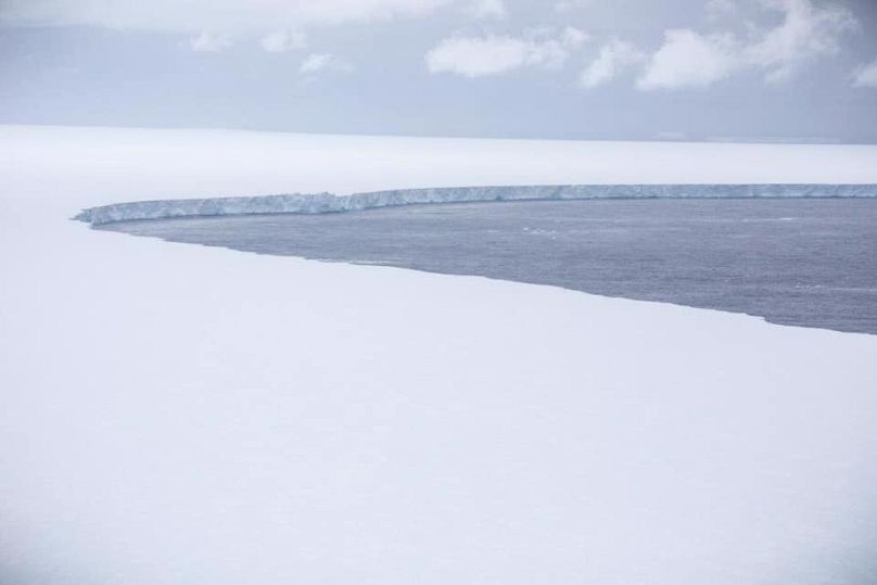
The sprawling 4,200-sq-km mass, called A68a, was on course towards the island of South Georgia.
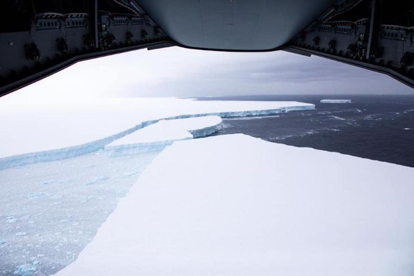
An aircraft from the UK's RAF has taken pictures of the world's biggest iceberg as it floated over the South Atlantic Ocean.
The sprawling 4,200-sq-km mass, called A68a, was on course towards the island of South Georgia.
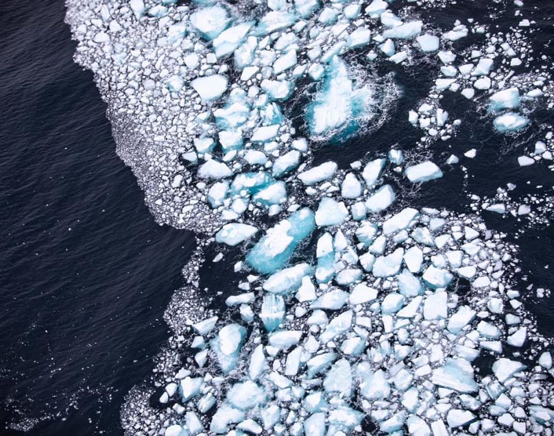
The iceberg's sheer size meant it was impossible to capture its entirety in one single shot from the A400M aircraft, according to the British Forces South Atlantic Islands (BFSAI), which performed the mission.
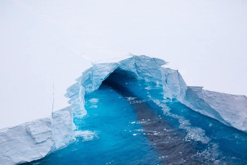
But the reconnaissance provided "close up" imagery of the mass and surrounding waters for observers and scientists to study.
It was able to observe "with unprecedented detail" cracks and fissures within the main body of the iceberg.
"I know I speak on behalf of all of the crew involved when I say this is certainly a unique and unforgettable task to be involved in," said Squadron Leader Michael Wilkinson, the officer commanding the fleet.
The A68a would usually have attracted the attention of the numerous cruise ships in the ocean during the summer, but due to the global coronavirus pandemic, cruise ship traffic has been negligible this year.
"Tabular icebergs and debris" were spotted breaking off from the main structure, which could pose a threat to patrol vessels including Royal Navy ships, the BFSAI said.
The force shared data collected by the A400M with both Government of South Georgia & the South Sandwich Islands (GSGSSI) and British Antarctic Survey (BAS) who are following the progress of the A68a
"The imagery stills, video footage and visual observations will all assist in predicting the iceberg’s future behaviour and ascertaining the scale of the threat to the local area," BFSAI said in a Facebook post.